Sogdiana High Route
Sogdiana High Route
The Sogdiana High Route in Tajikistan takes you on a hike through the mountains of what was once the eastern highlands of the Sogdian civilization (6th century BC to 11th century AD), also known as Sogdiana. At times the route goes on very well-travelled tourist routes in the Fann Mountains and the Yaghnob Valley, but it more often leaves these trails and goes over high passes and open terrain at high altitudes, as well as shepherd trails rarely or never visited by tourists.
In total this is a 460km route through western Tajikistan that can be longer or shorter depending on how many side trips or longer route options you choose or skip. It starts in the village of Moghiyon near the border with Uzbekistan and ends in the upper Zarafshon River valley. The map below can be better viewed at this link on Google Earth.
The “Sogdiana High Route” does not exist as any sort of official trail. I just picked a local historical name for a route that I’ve been exploring since 2012. There is no established trail, and limited infrastructure to support hikers. It is just a random connection of shepherd trails. And, for planning to do the entire route, there is only one account to go on – this one (there are trip reports for shorter stretches of this route, but mostly in Russian). In addition to the GPS tracks and waypoints below, you need to carefully read through the full guide.
Download the GPX and waypoints file for the Sogdiana High Route.
The route is selected based on diversity of scenery and environment. It avoids staying in one natural geographic zone or elevation range for too long. There is also a compromise between traveling through the best scenery in the most isolated places, and the need to restock on food and charge batteries.
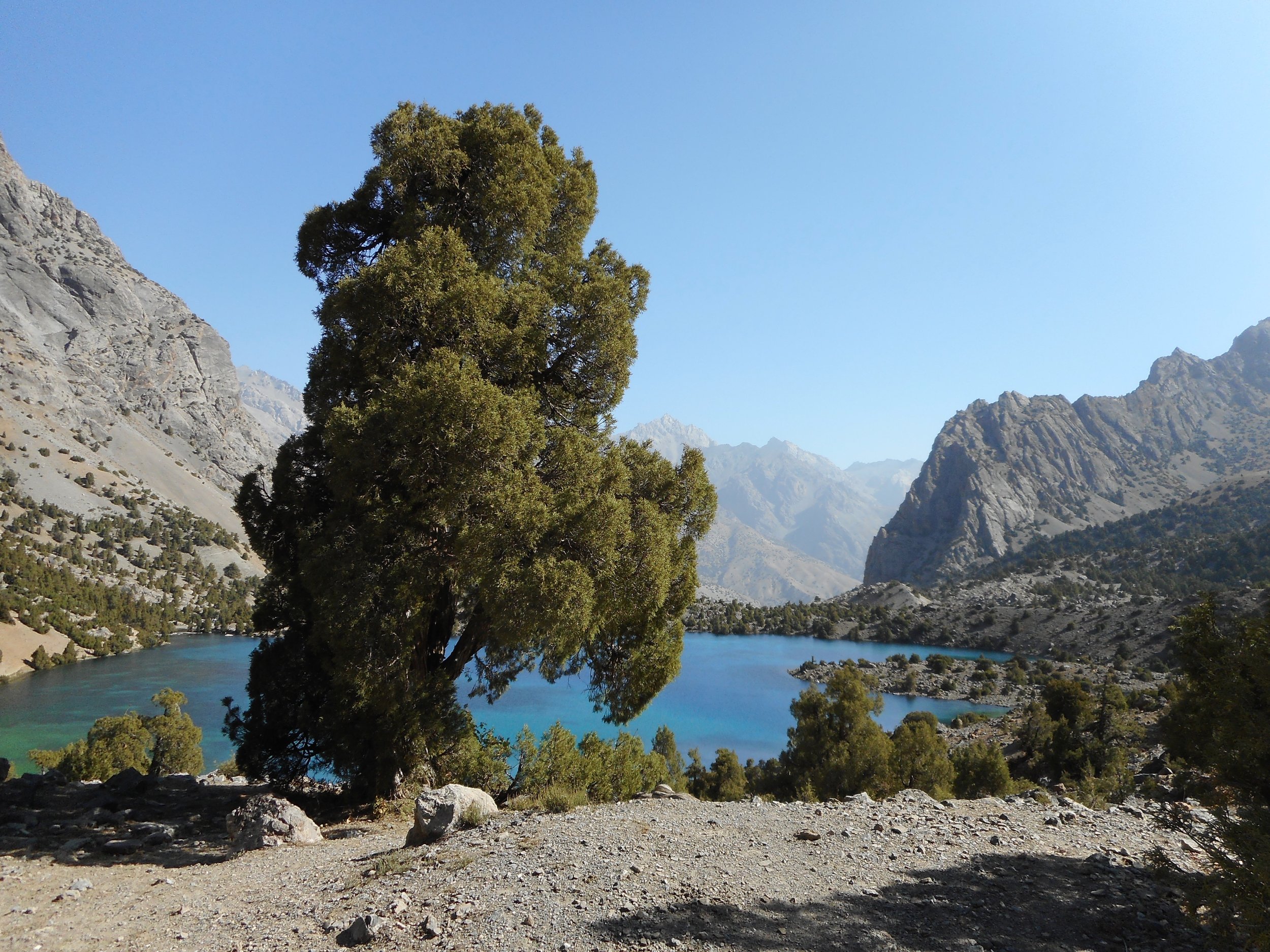
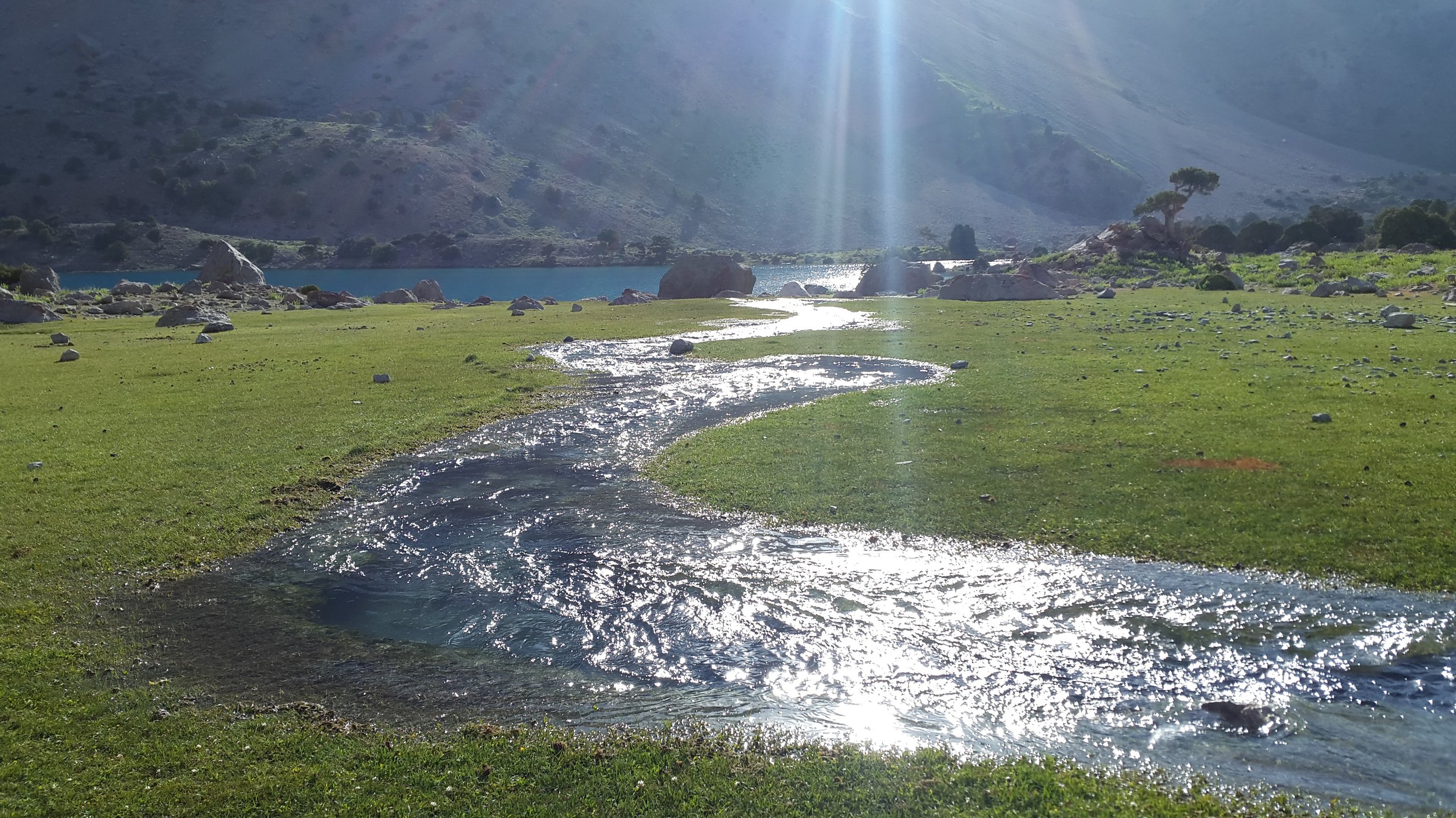
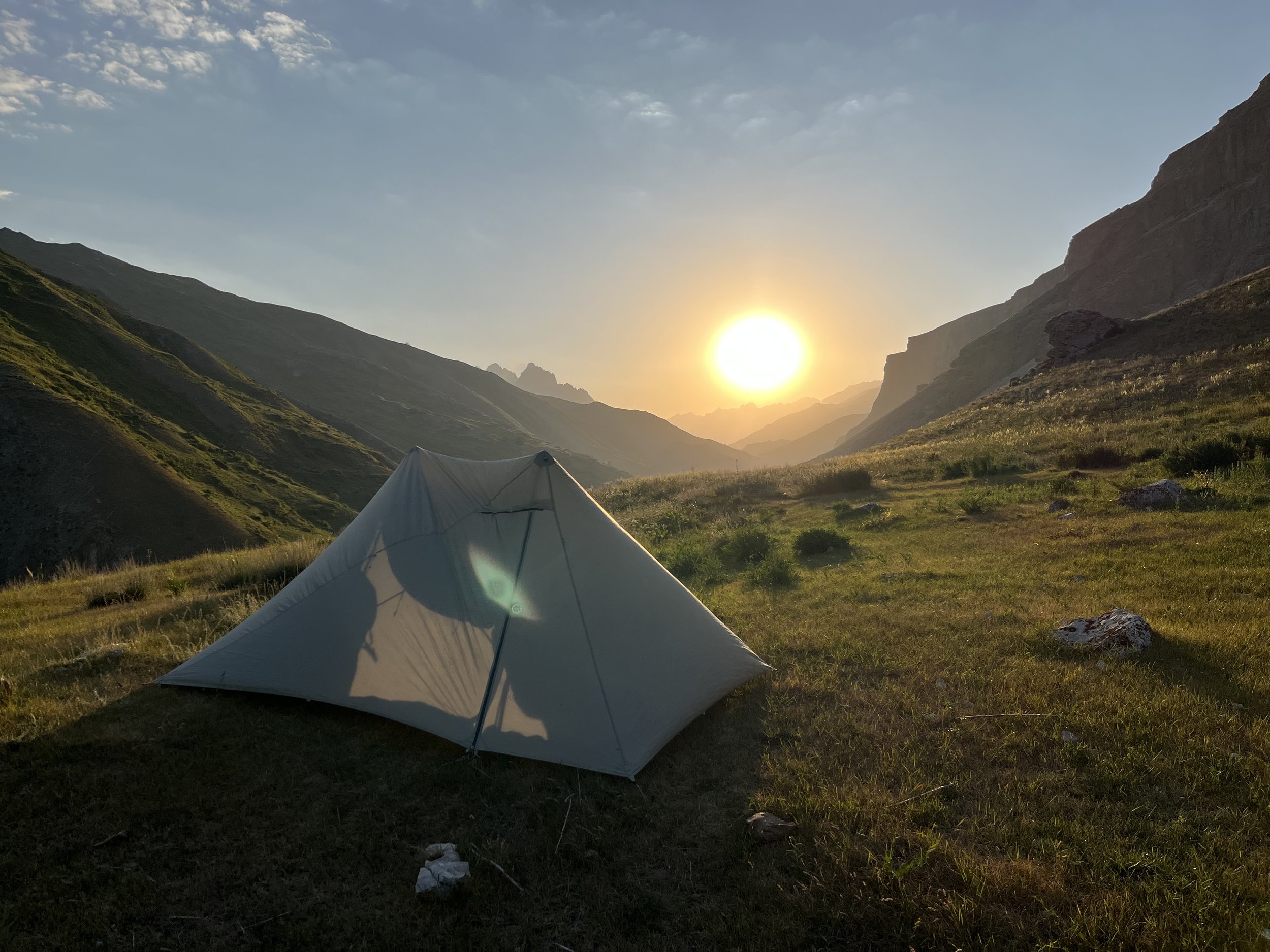
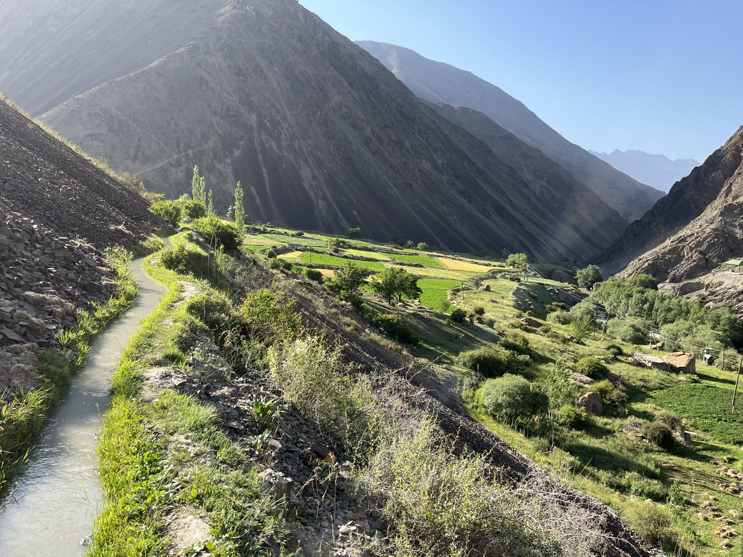
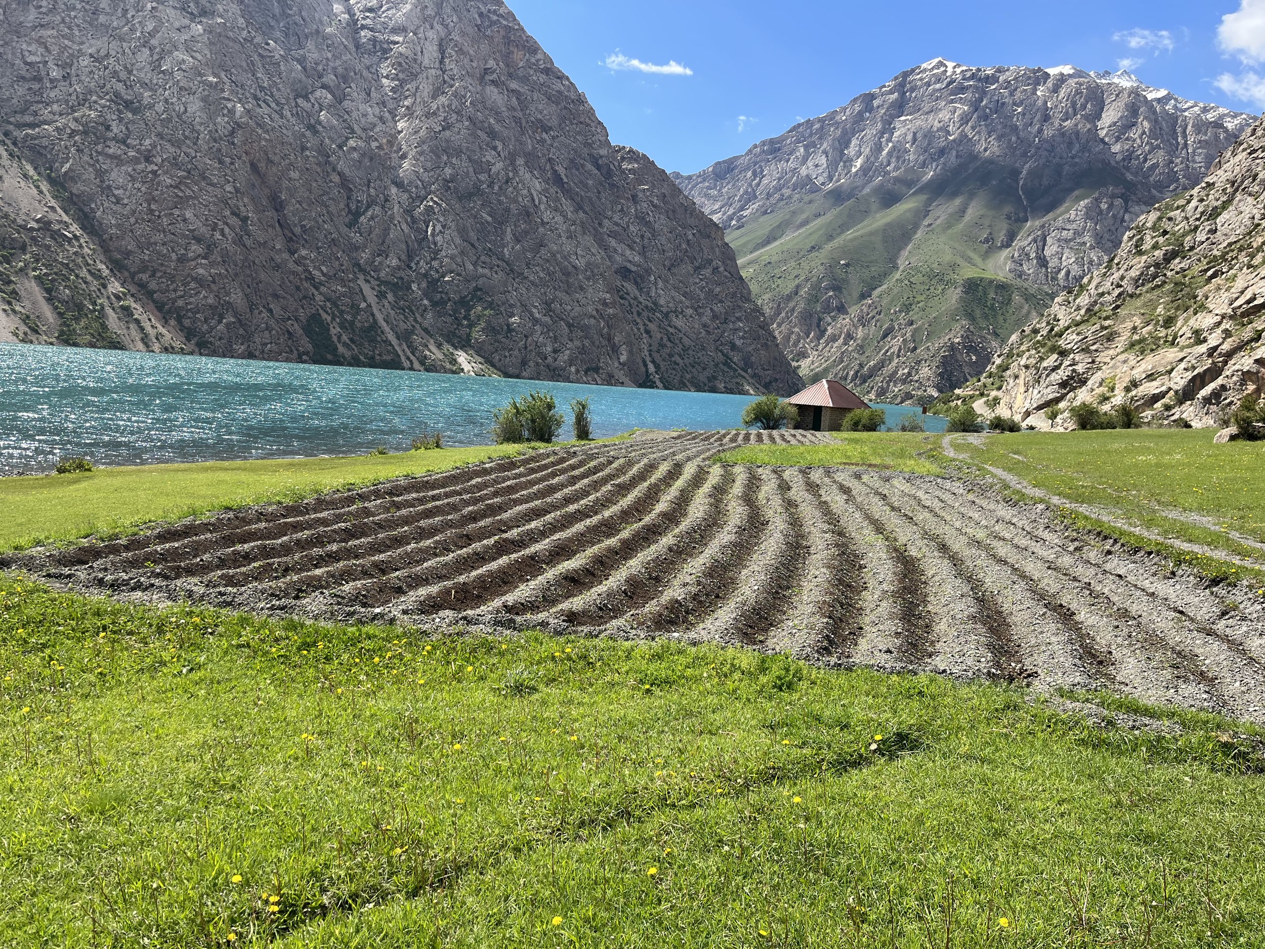
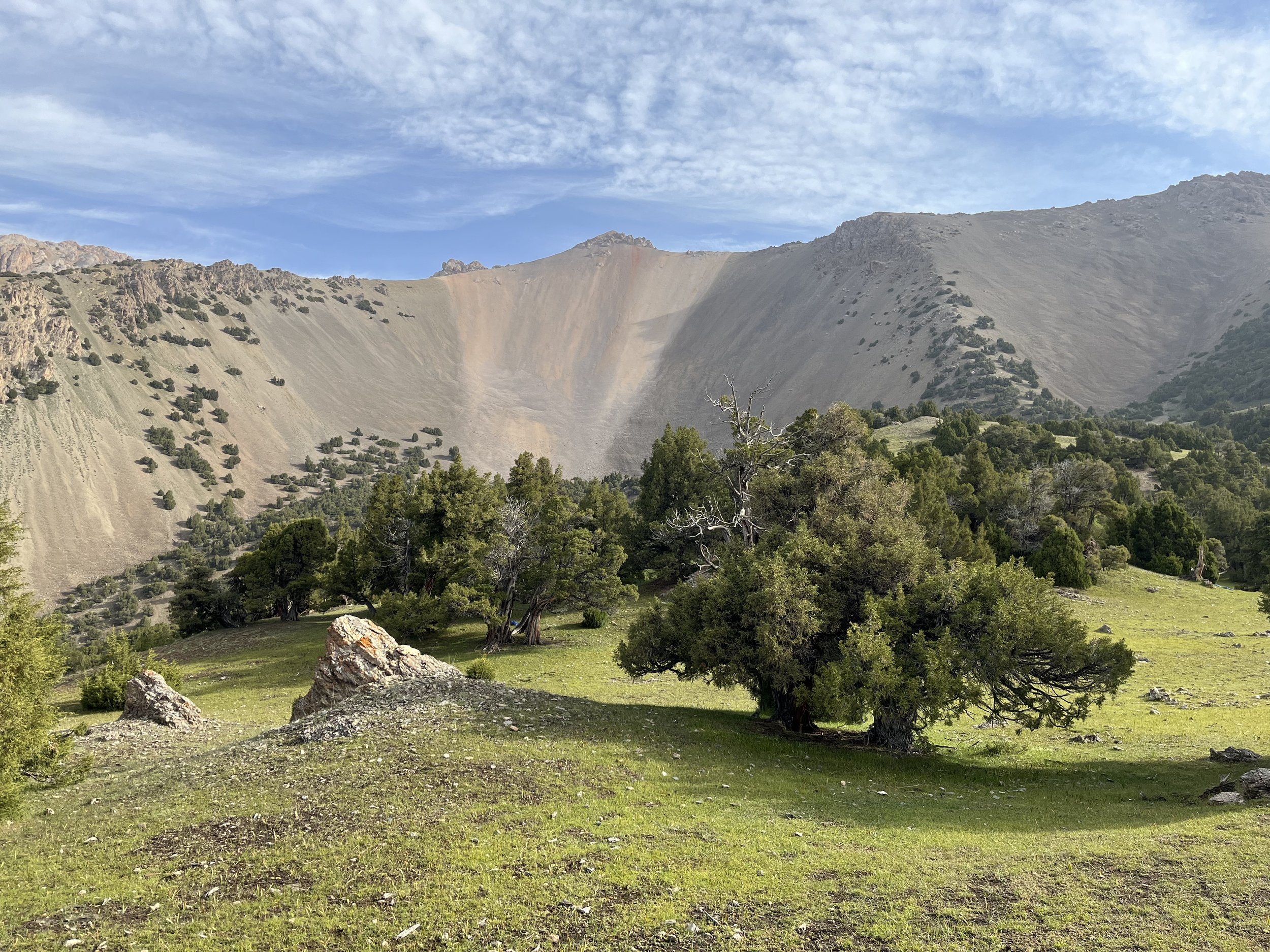
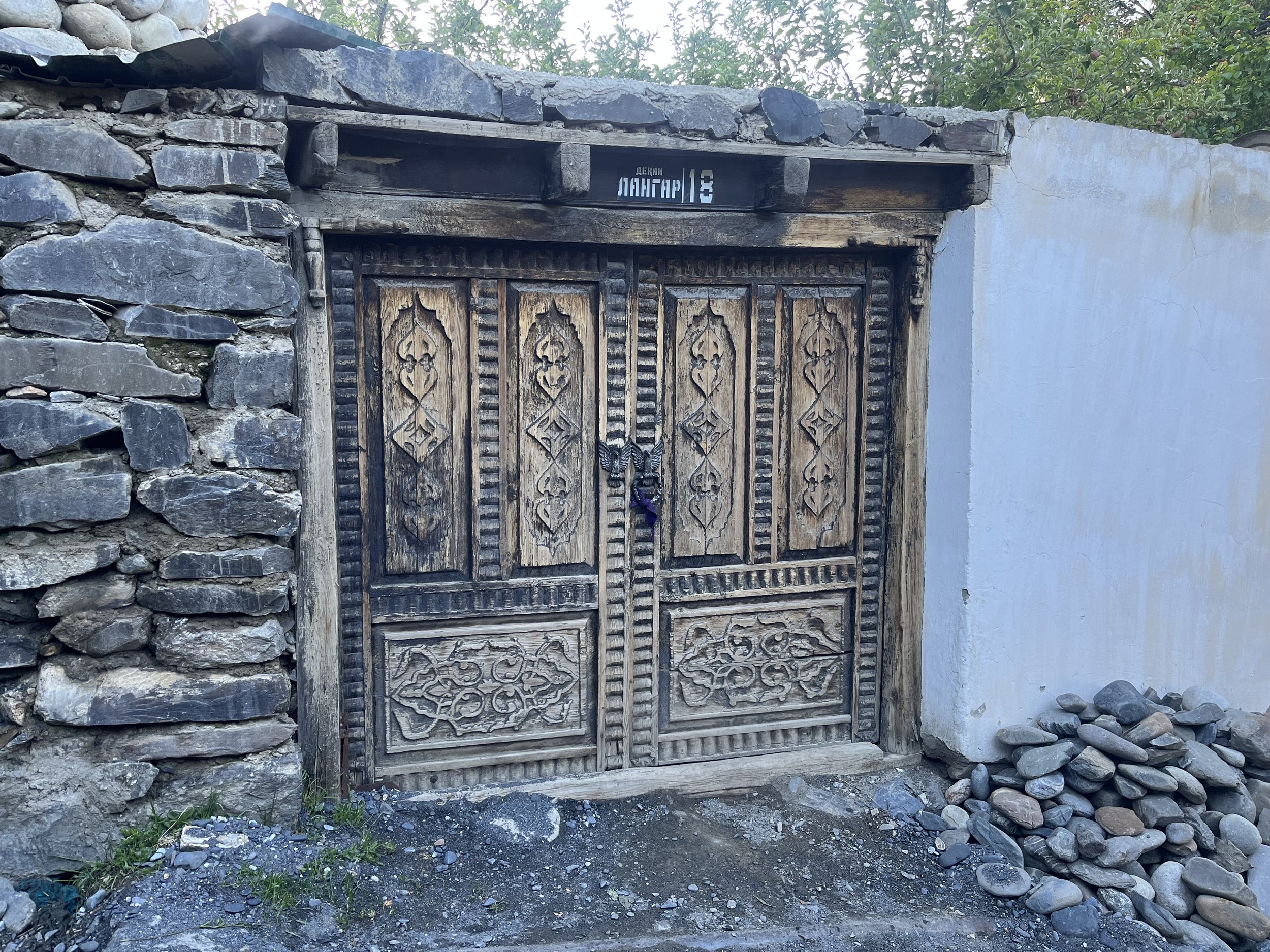
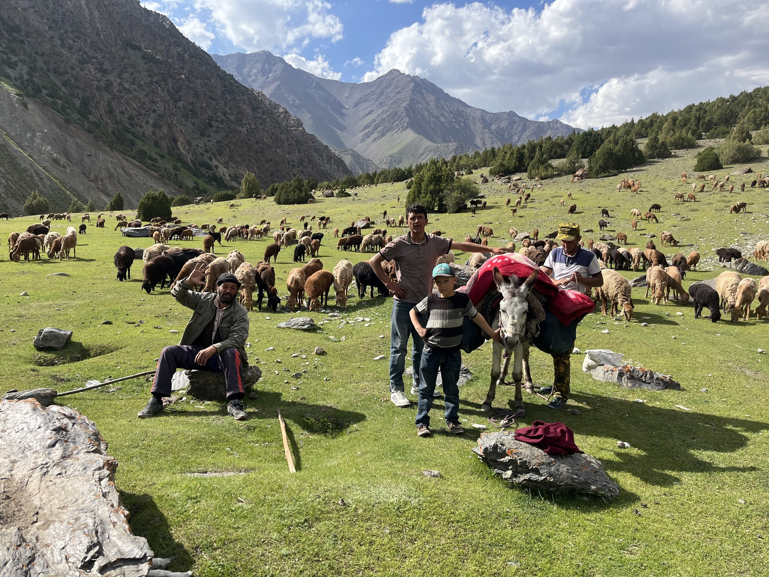
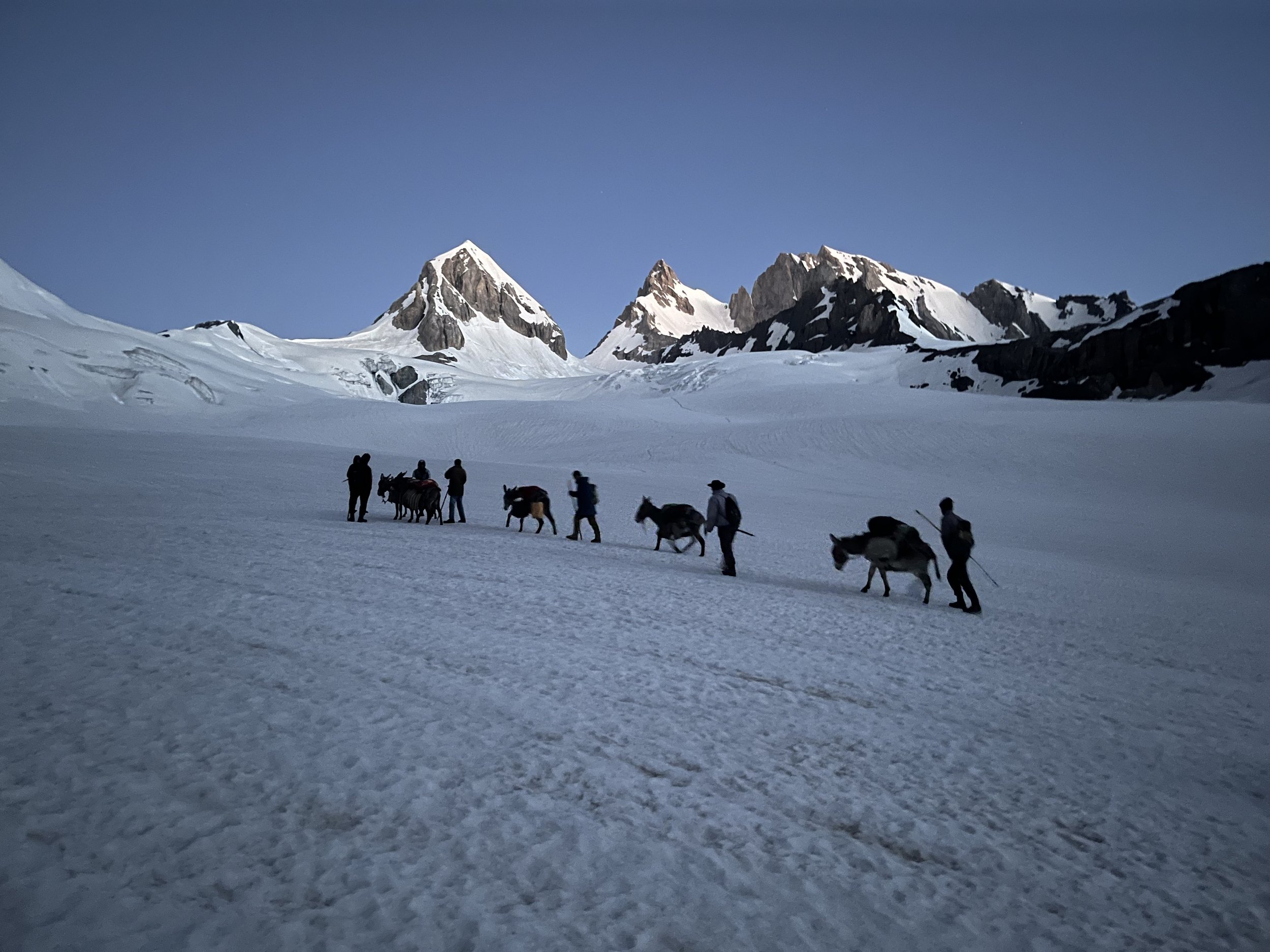
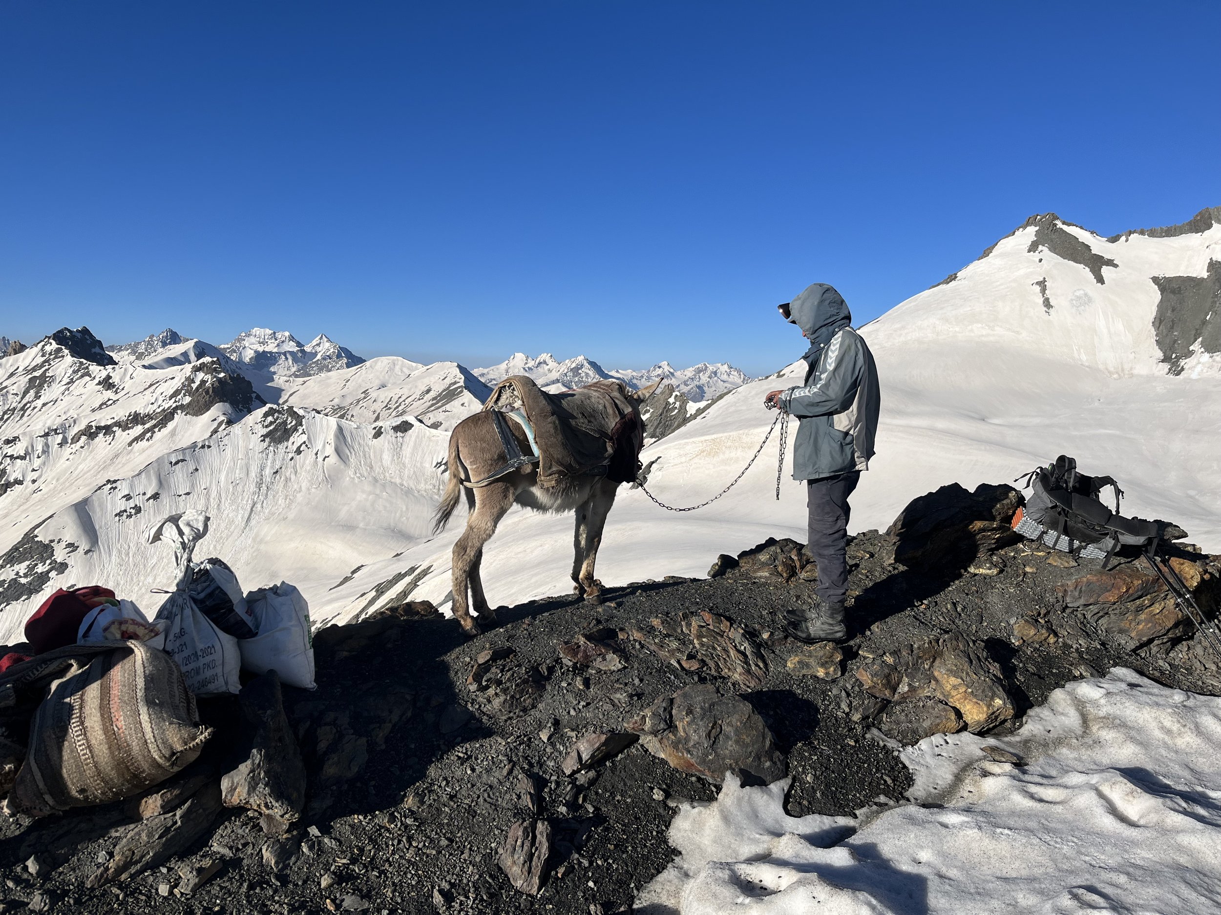
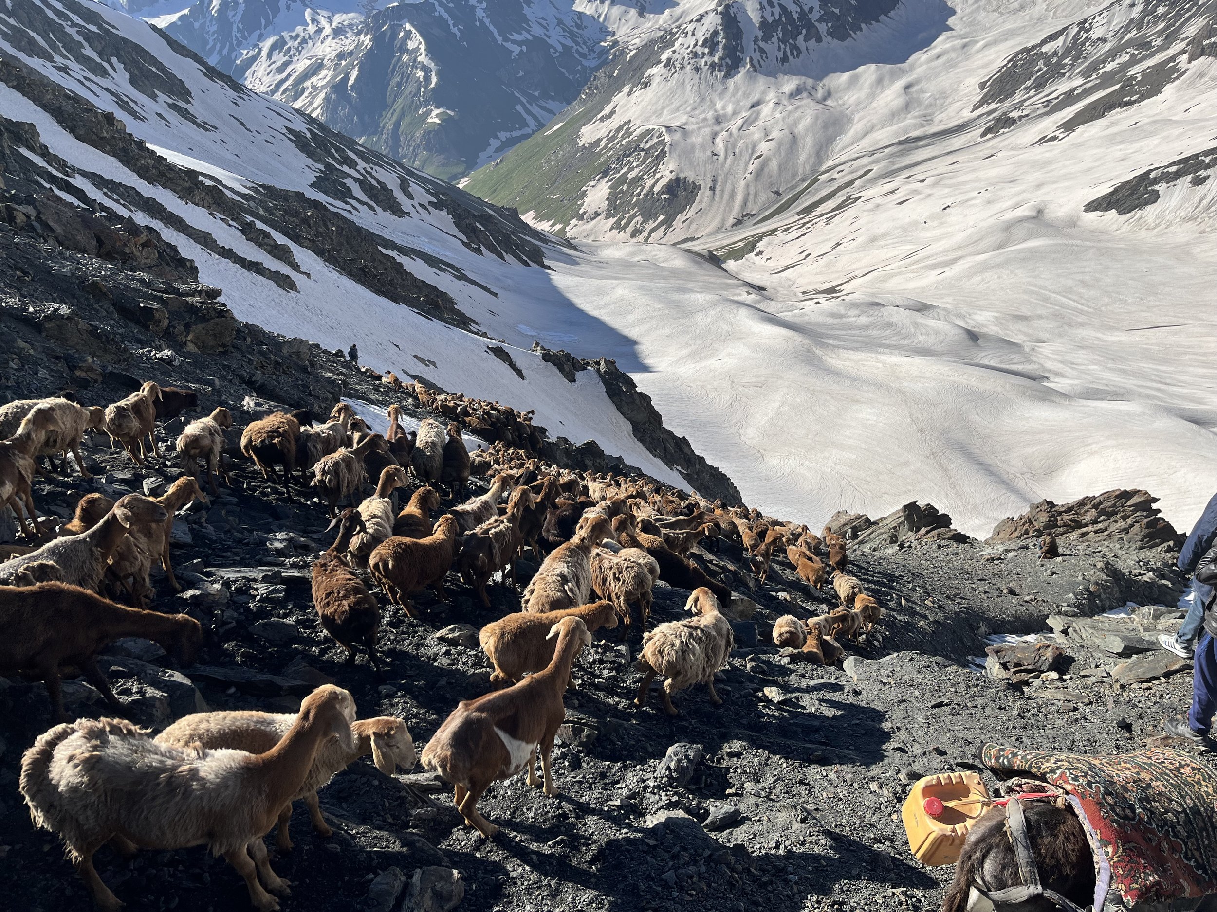
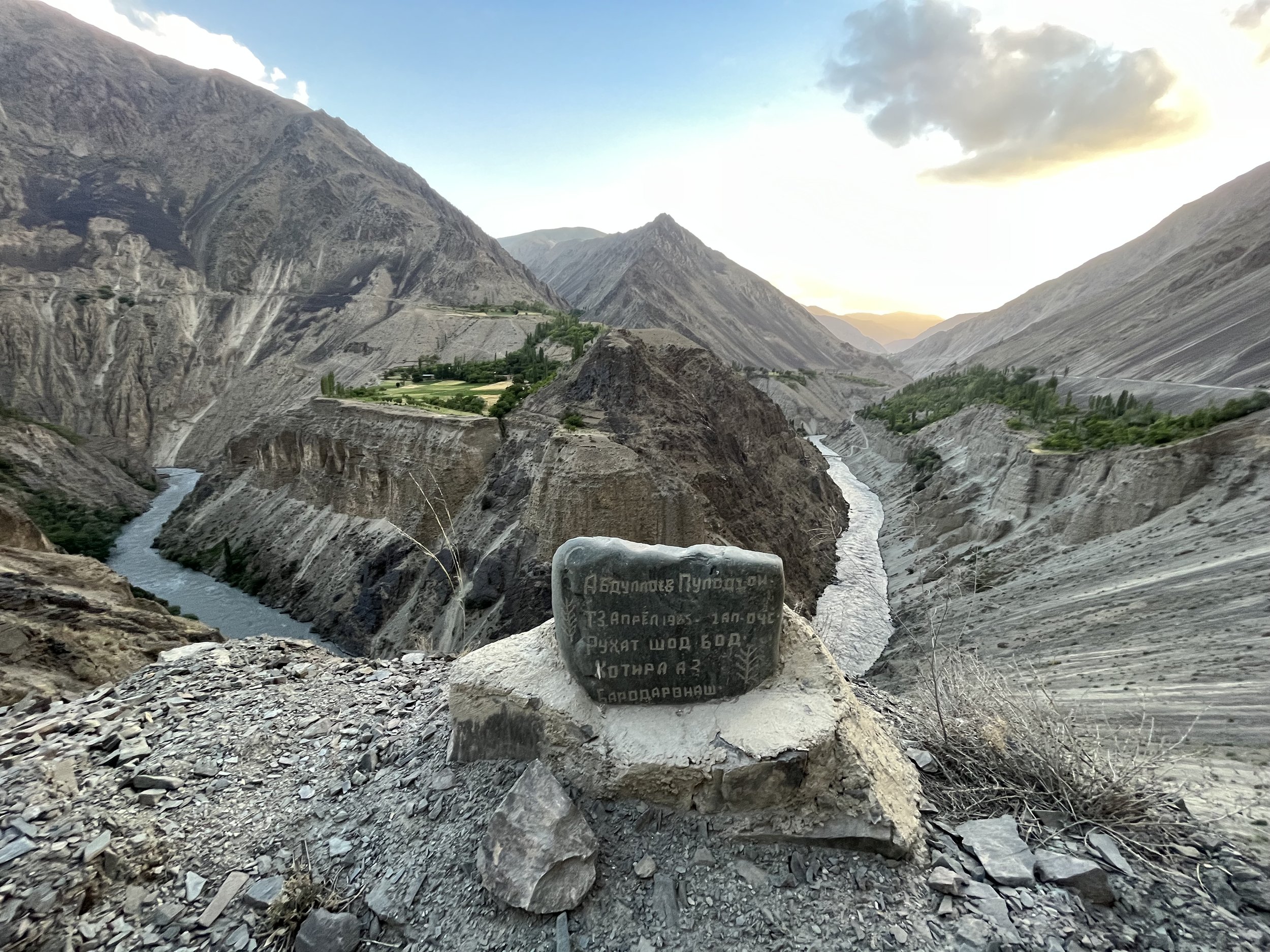
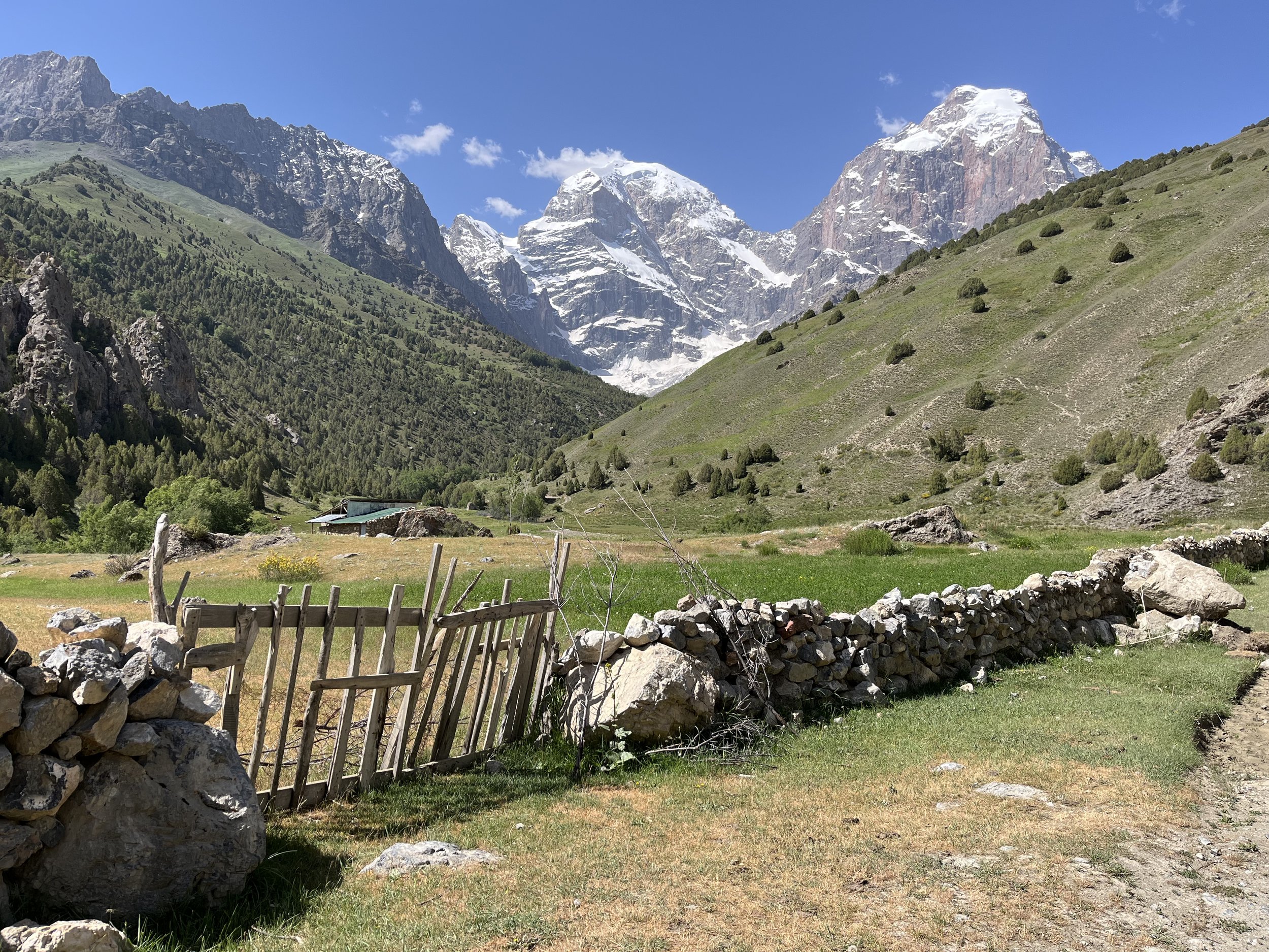
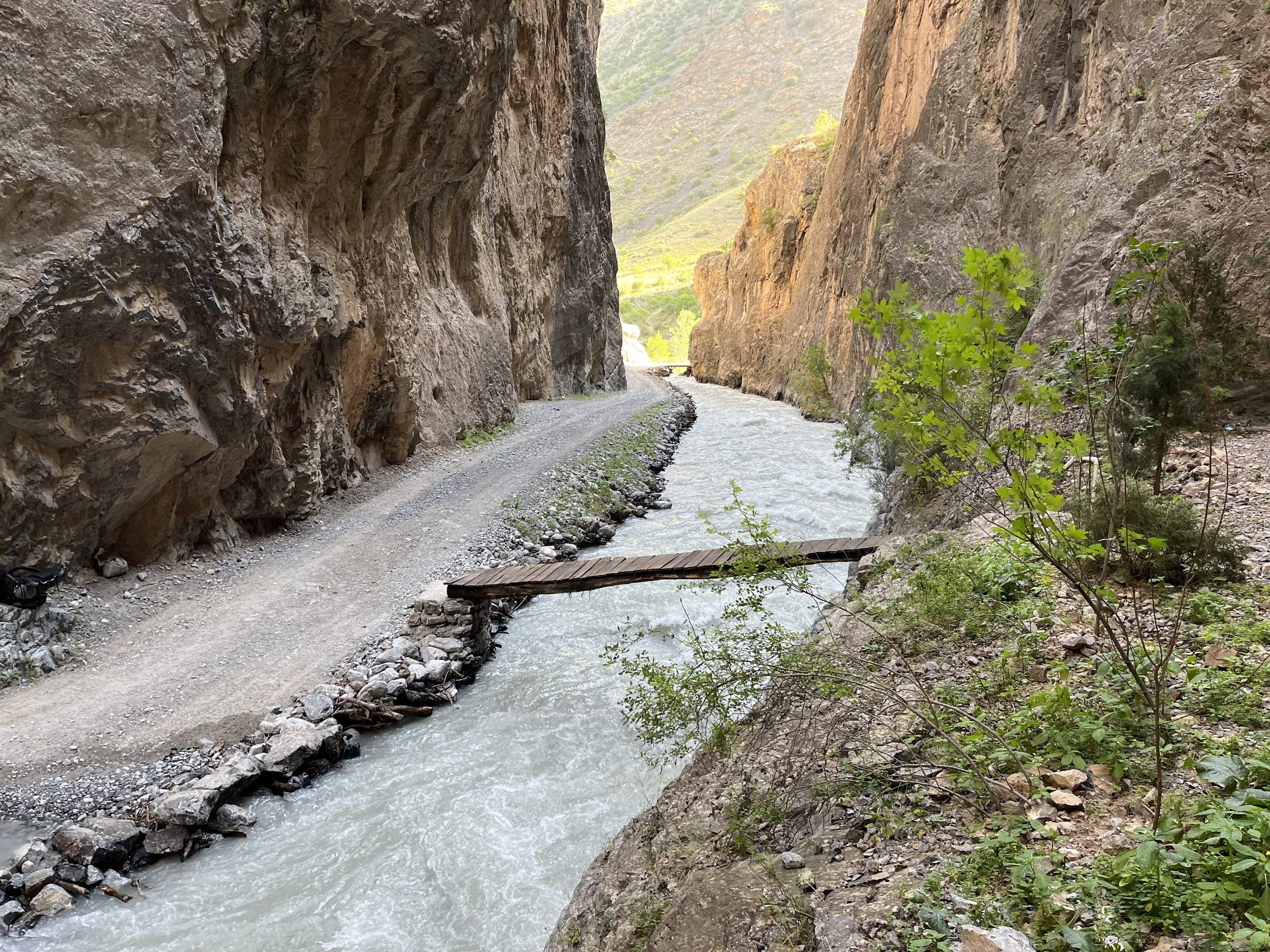
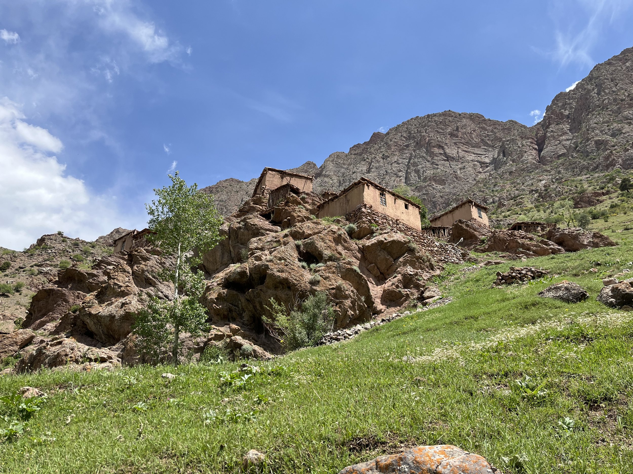
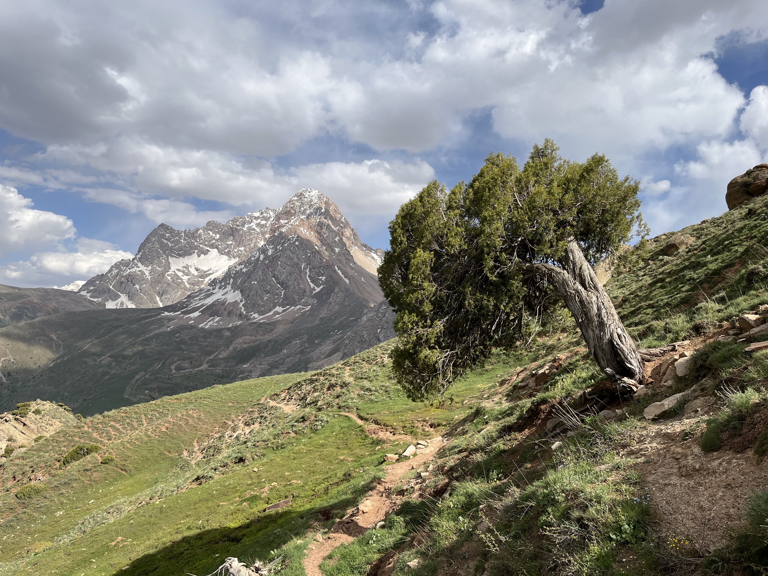
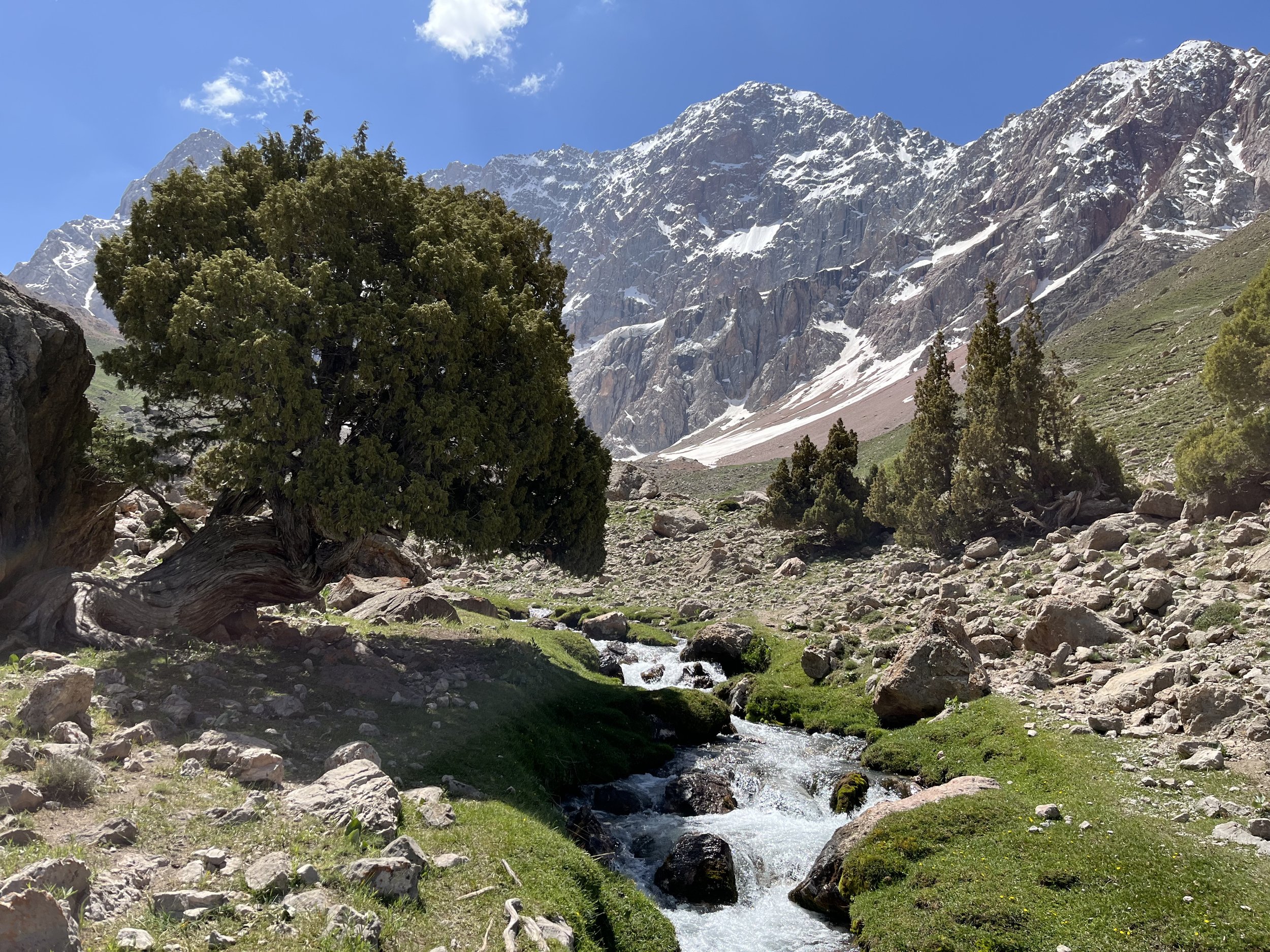
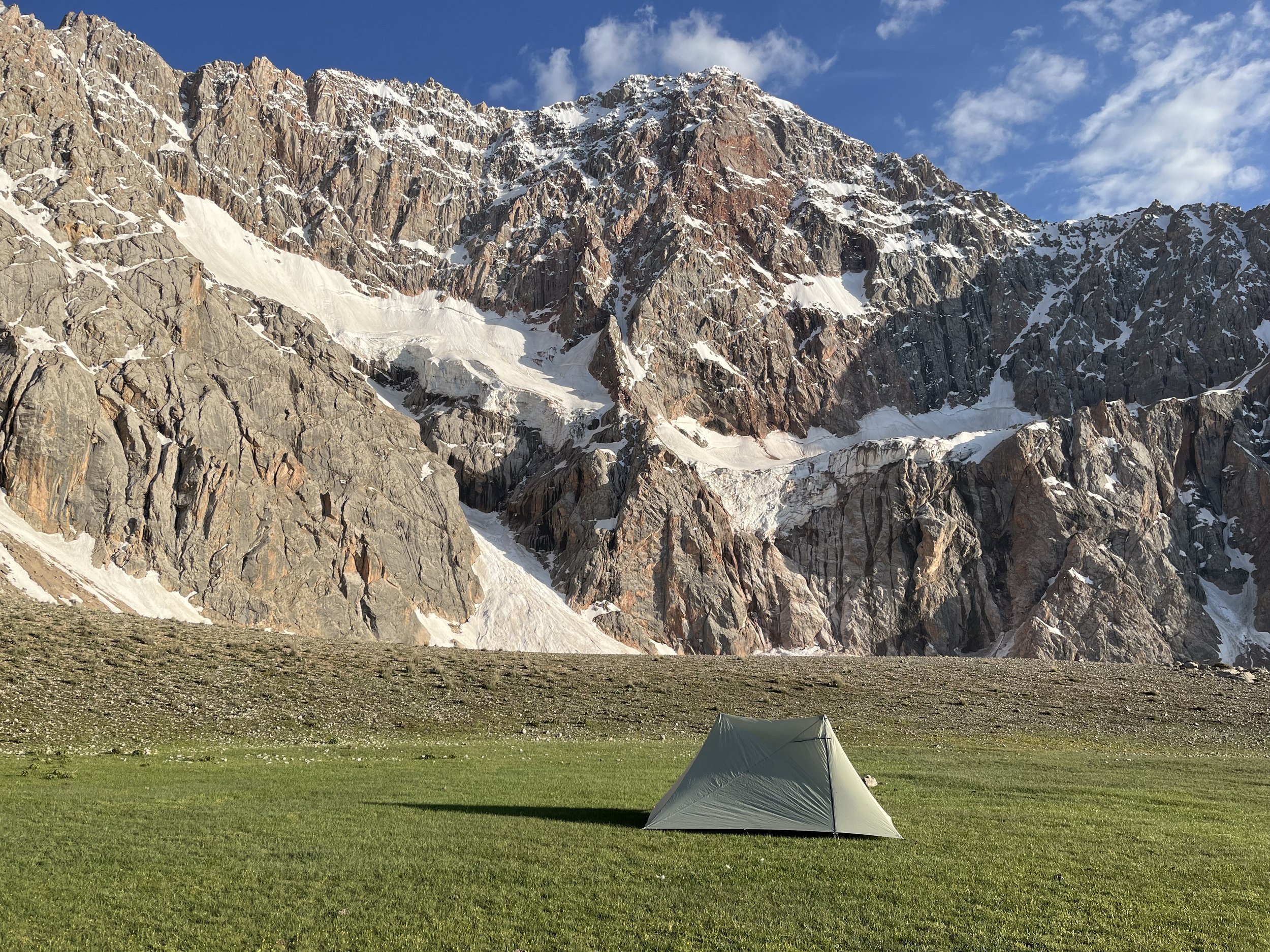
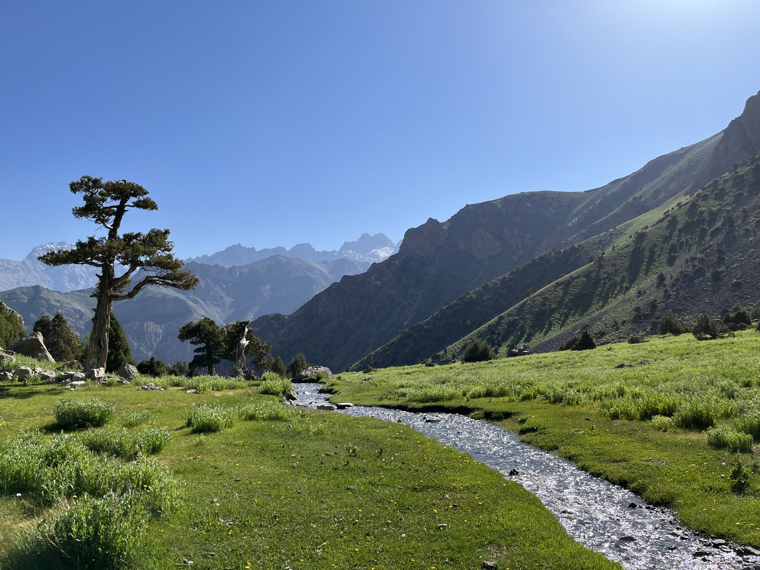
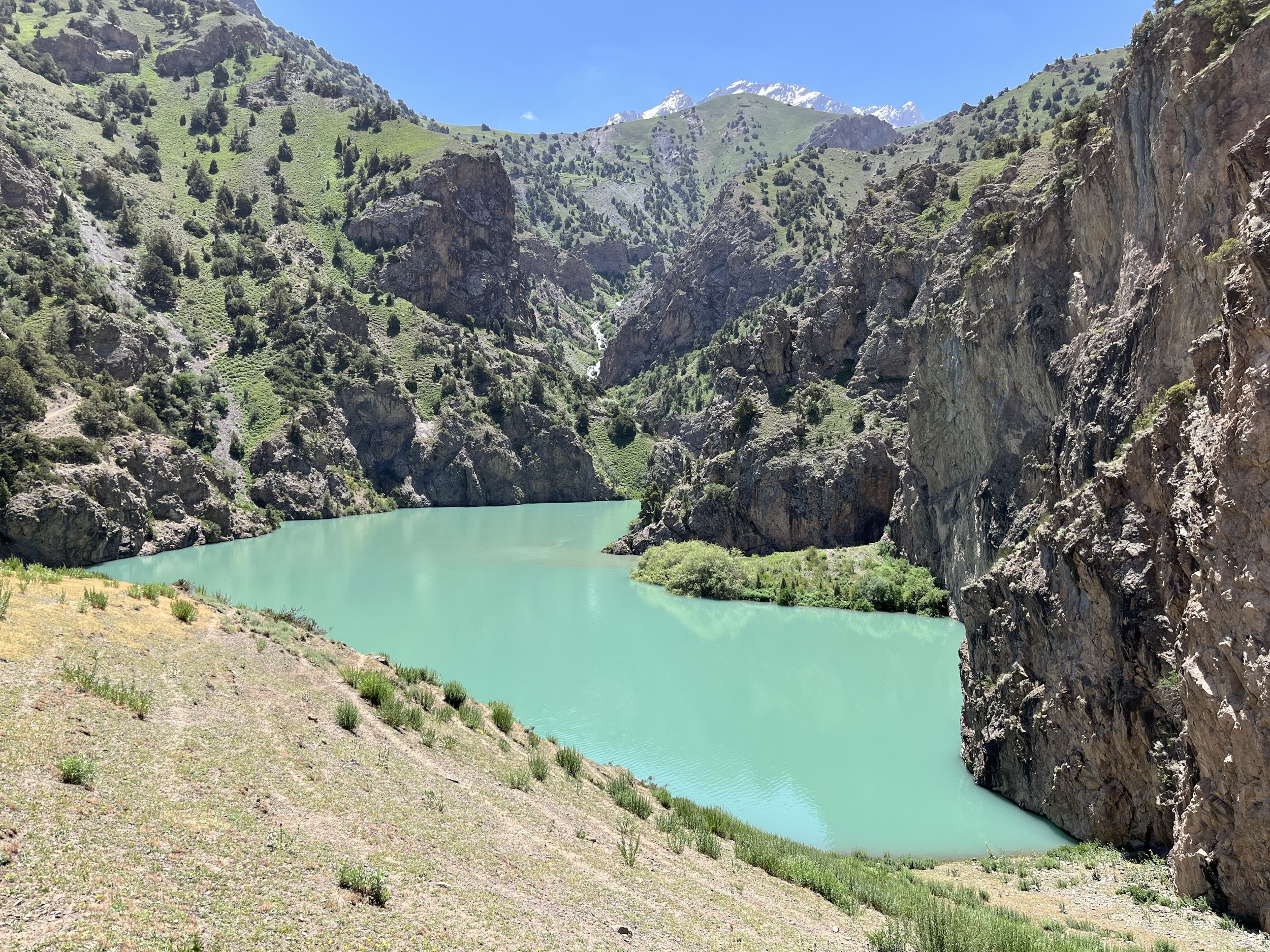
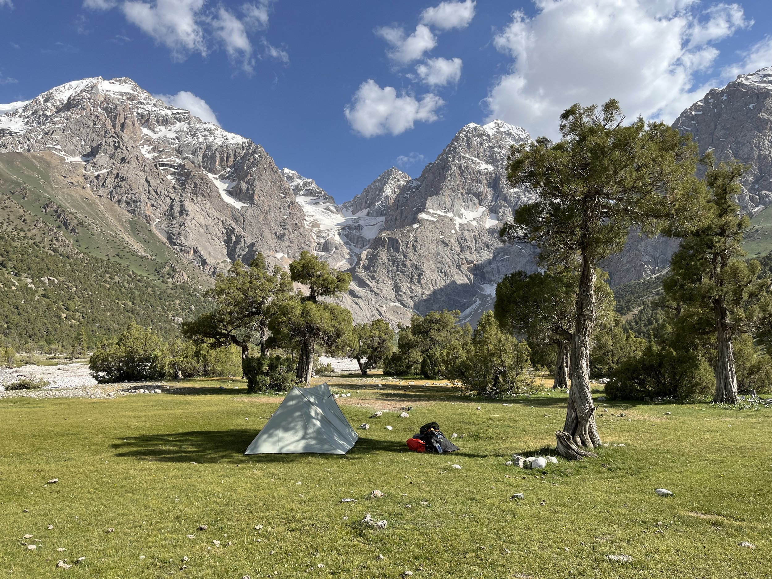
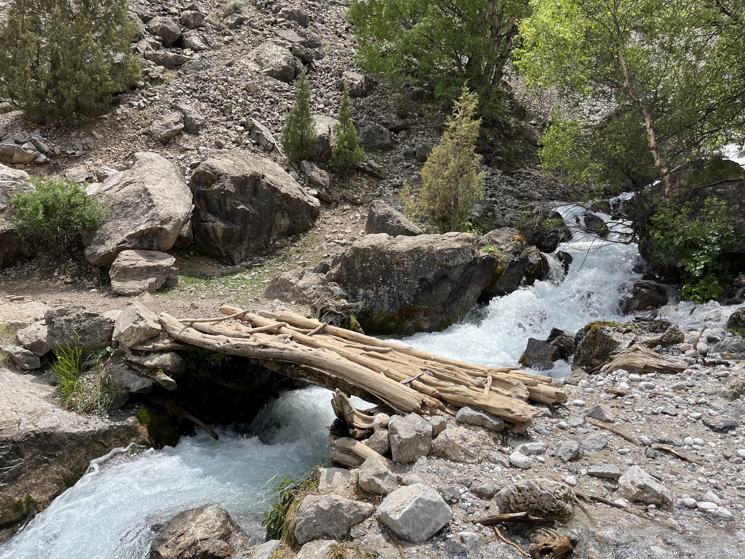
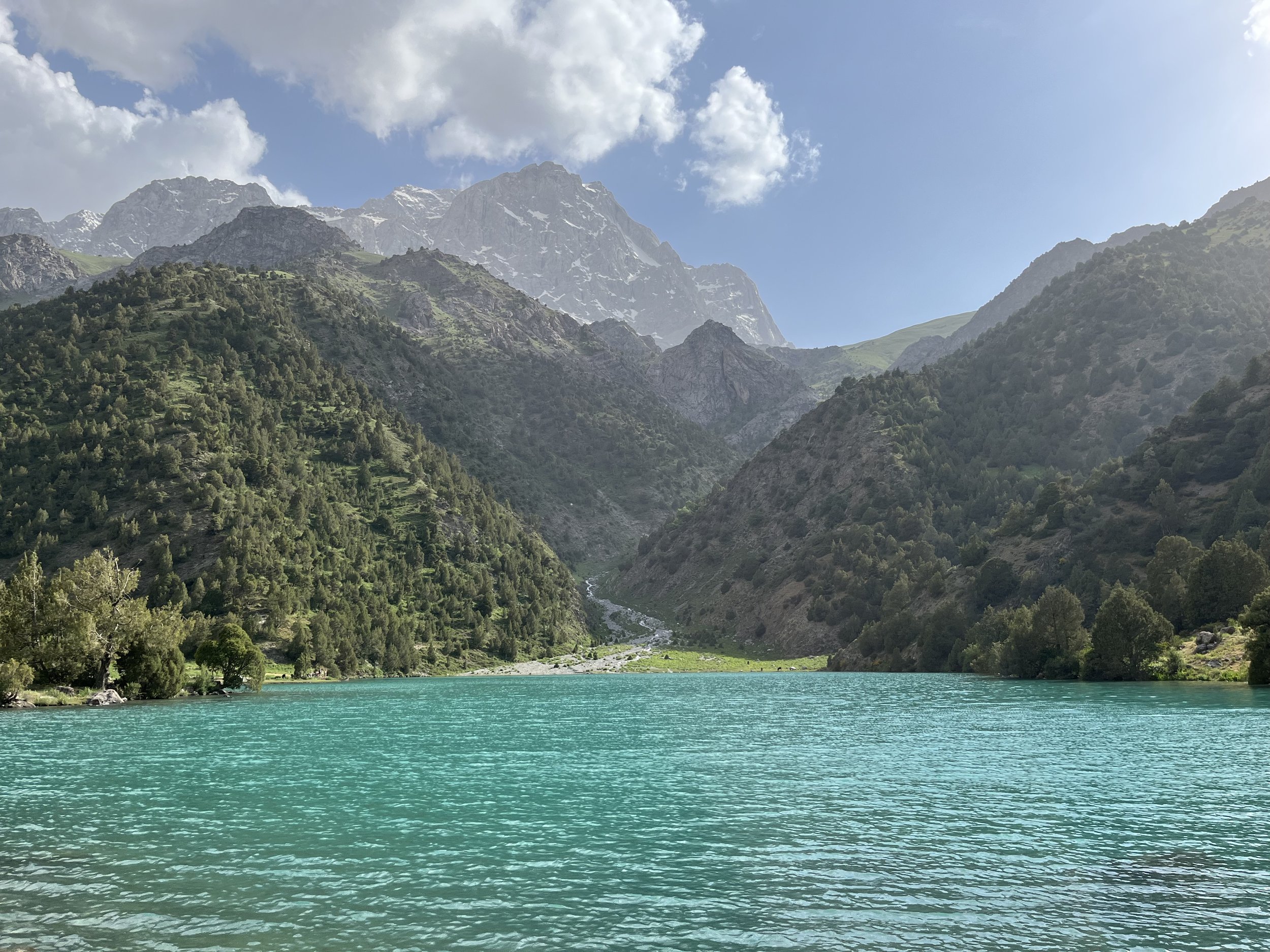
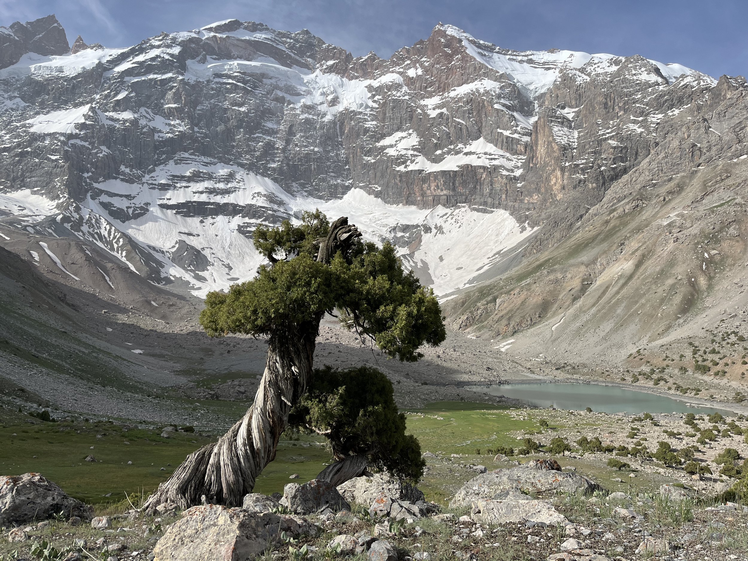
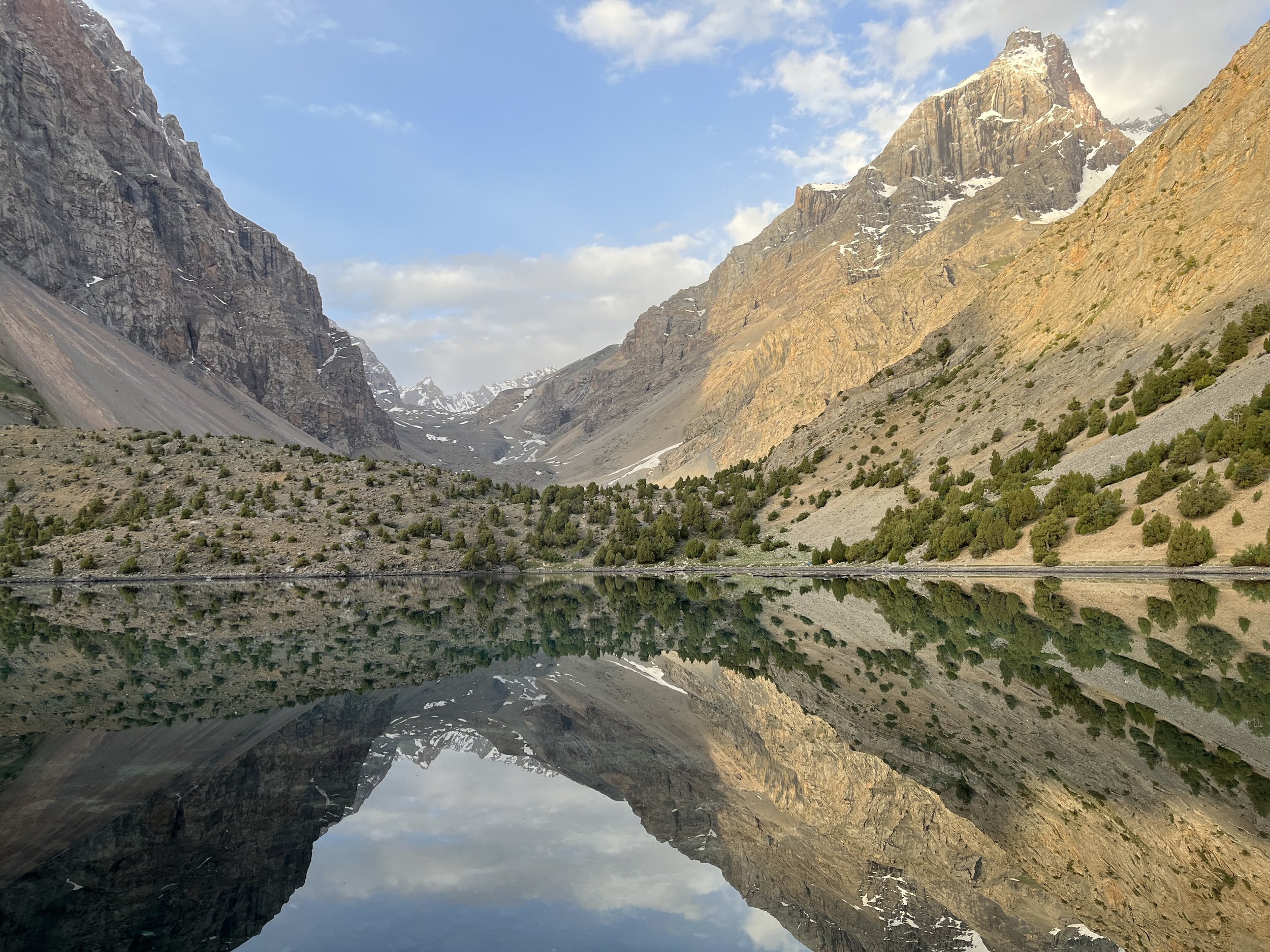
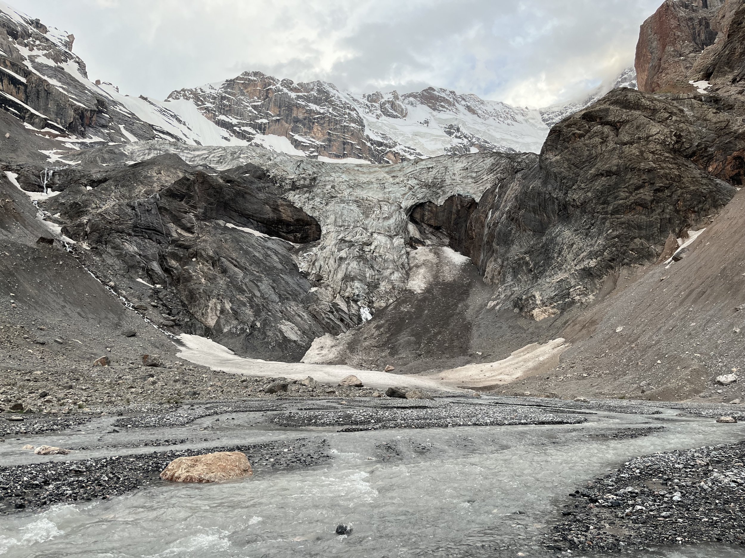
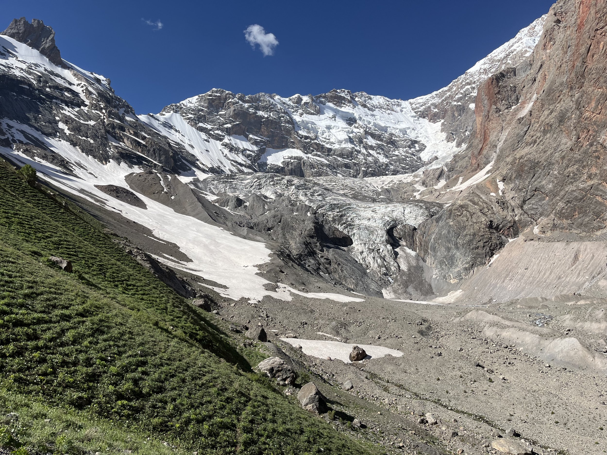
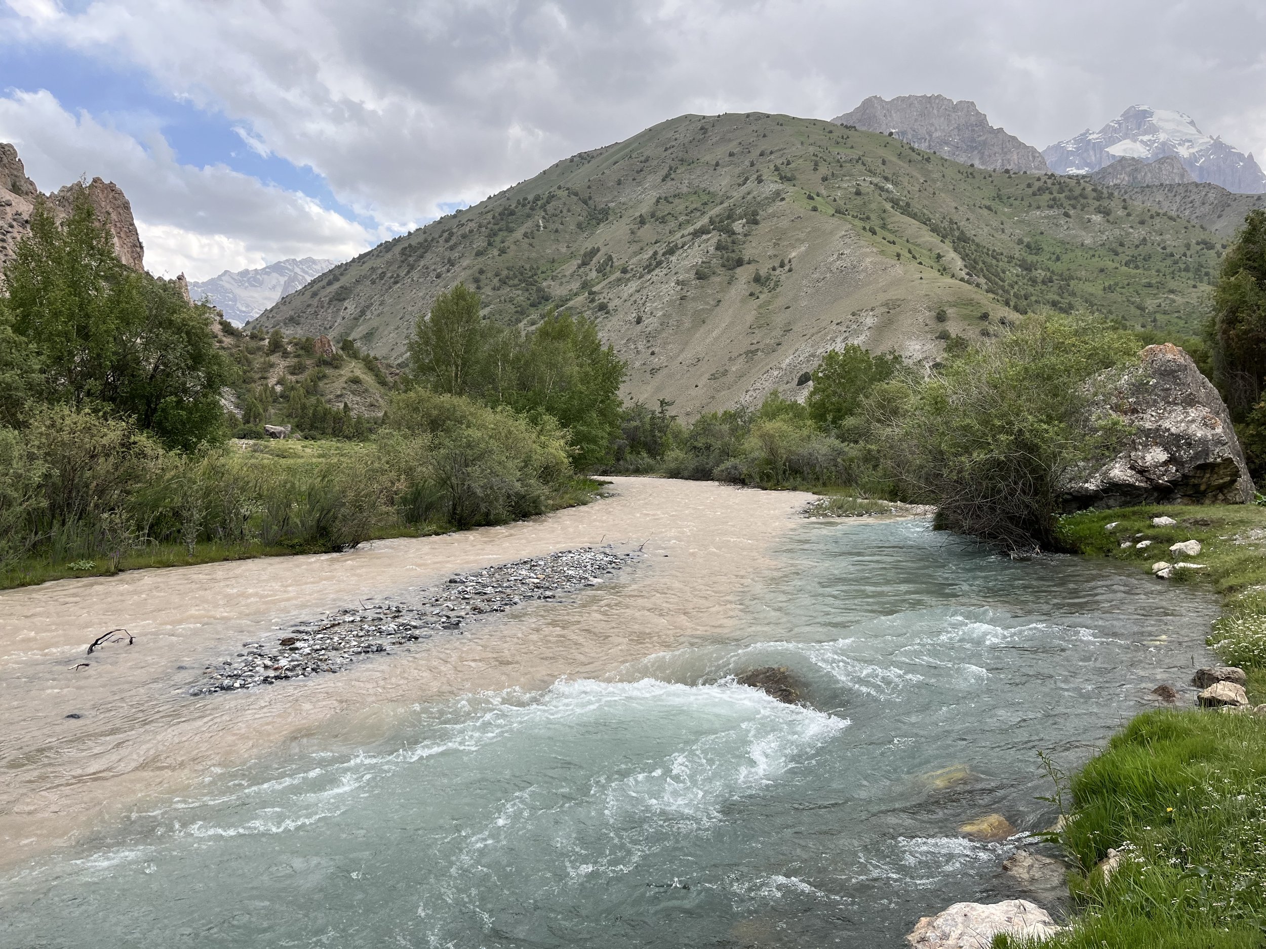
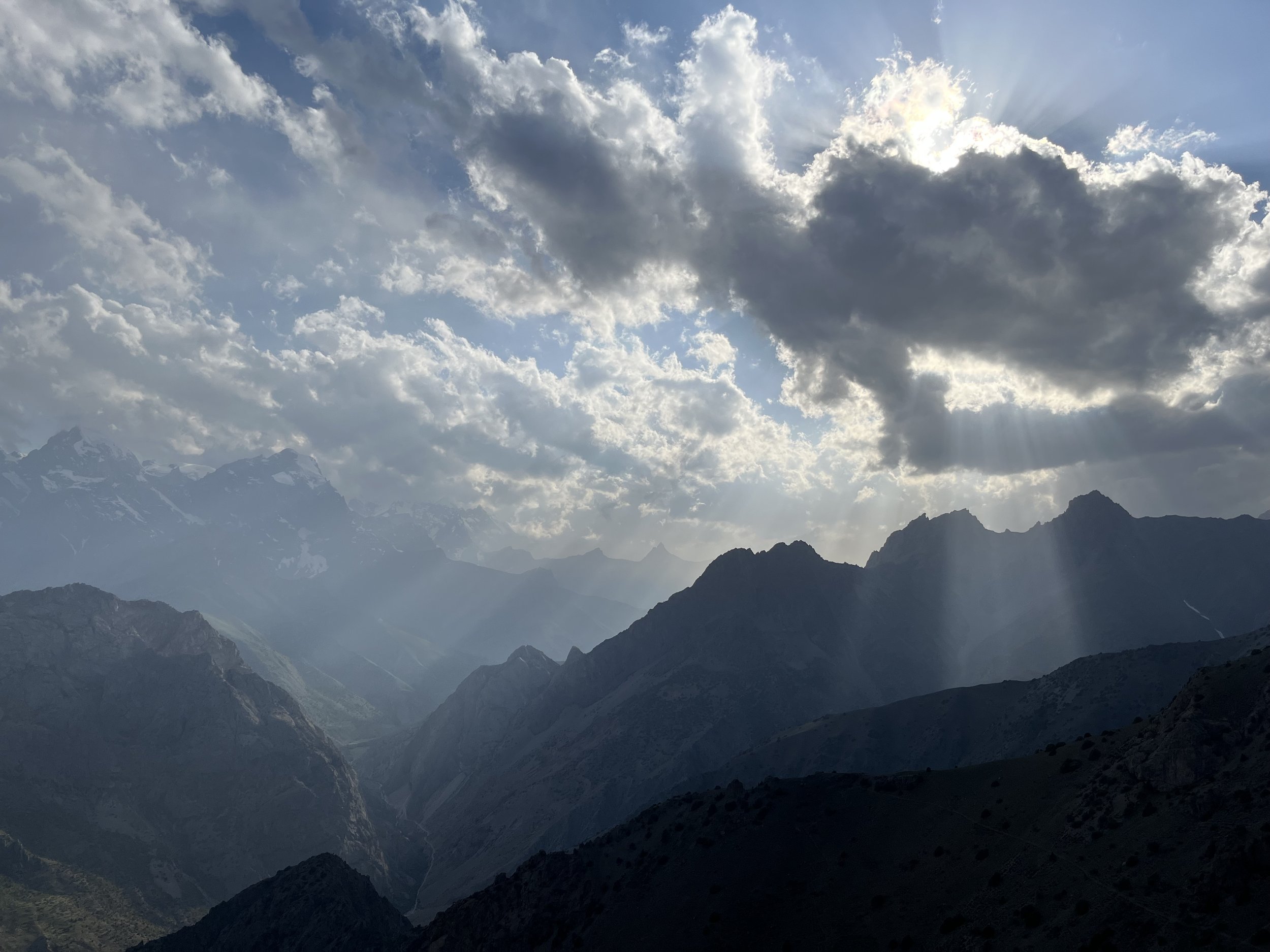
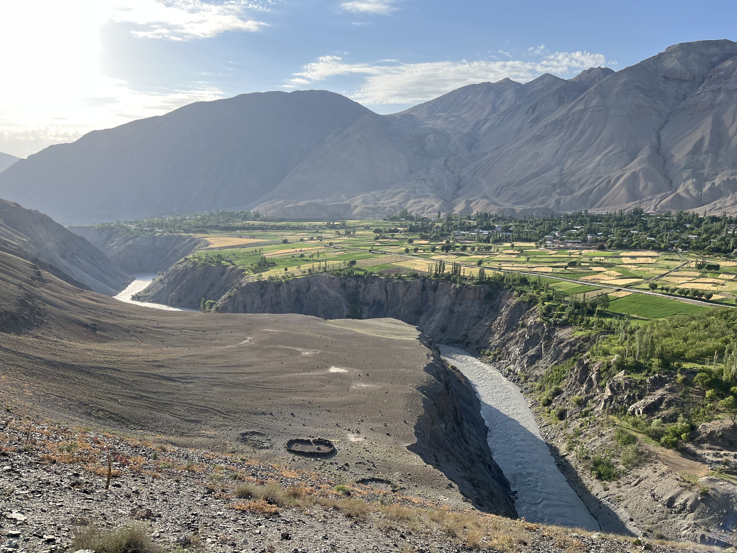
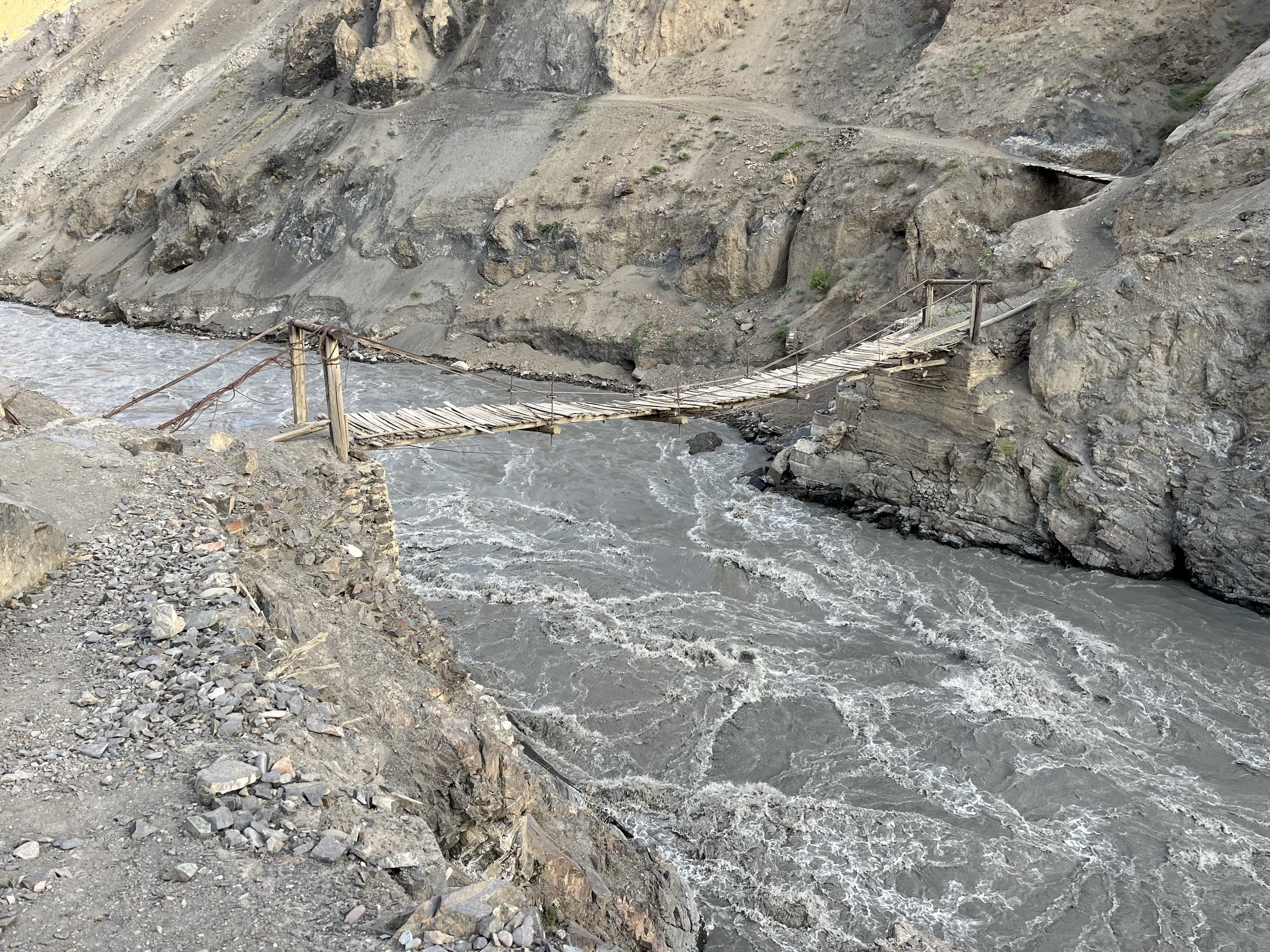
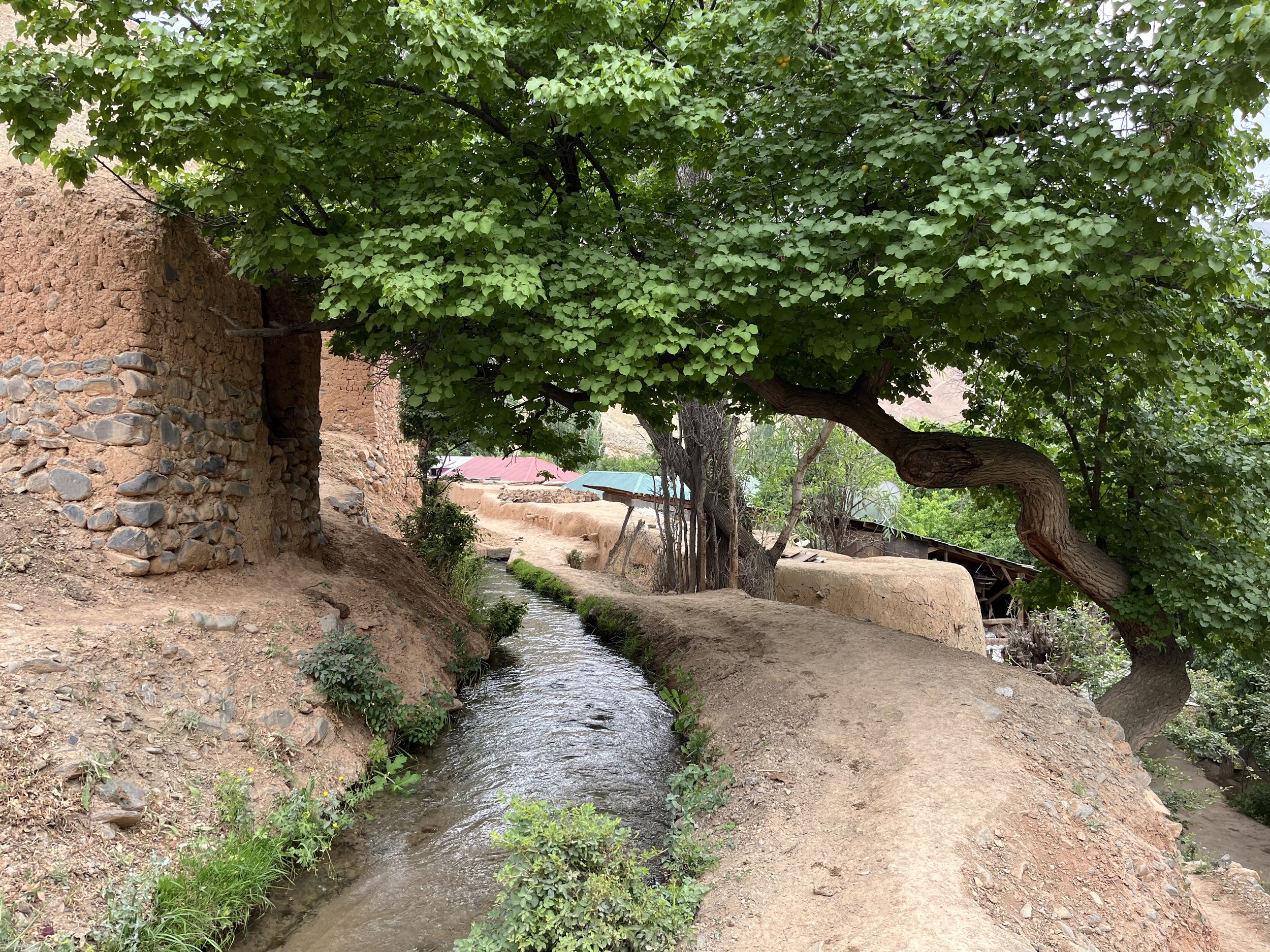
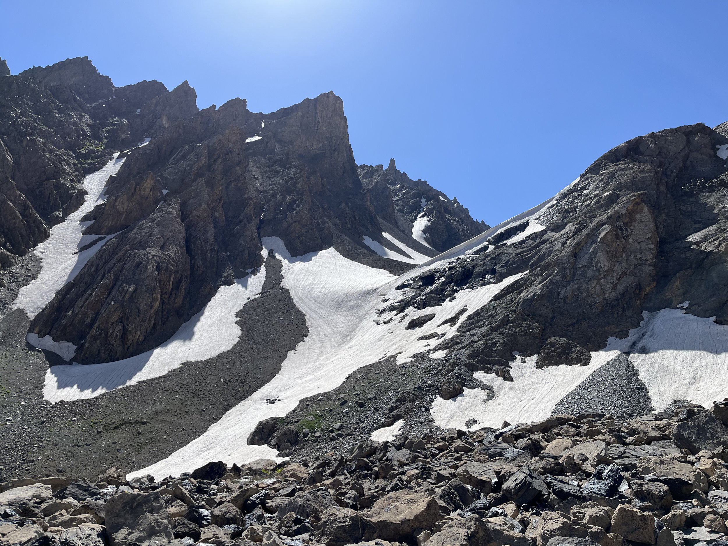
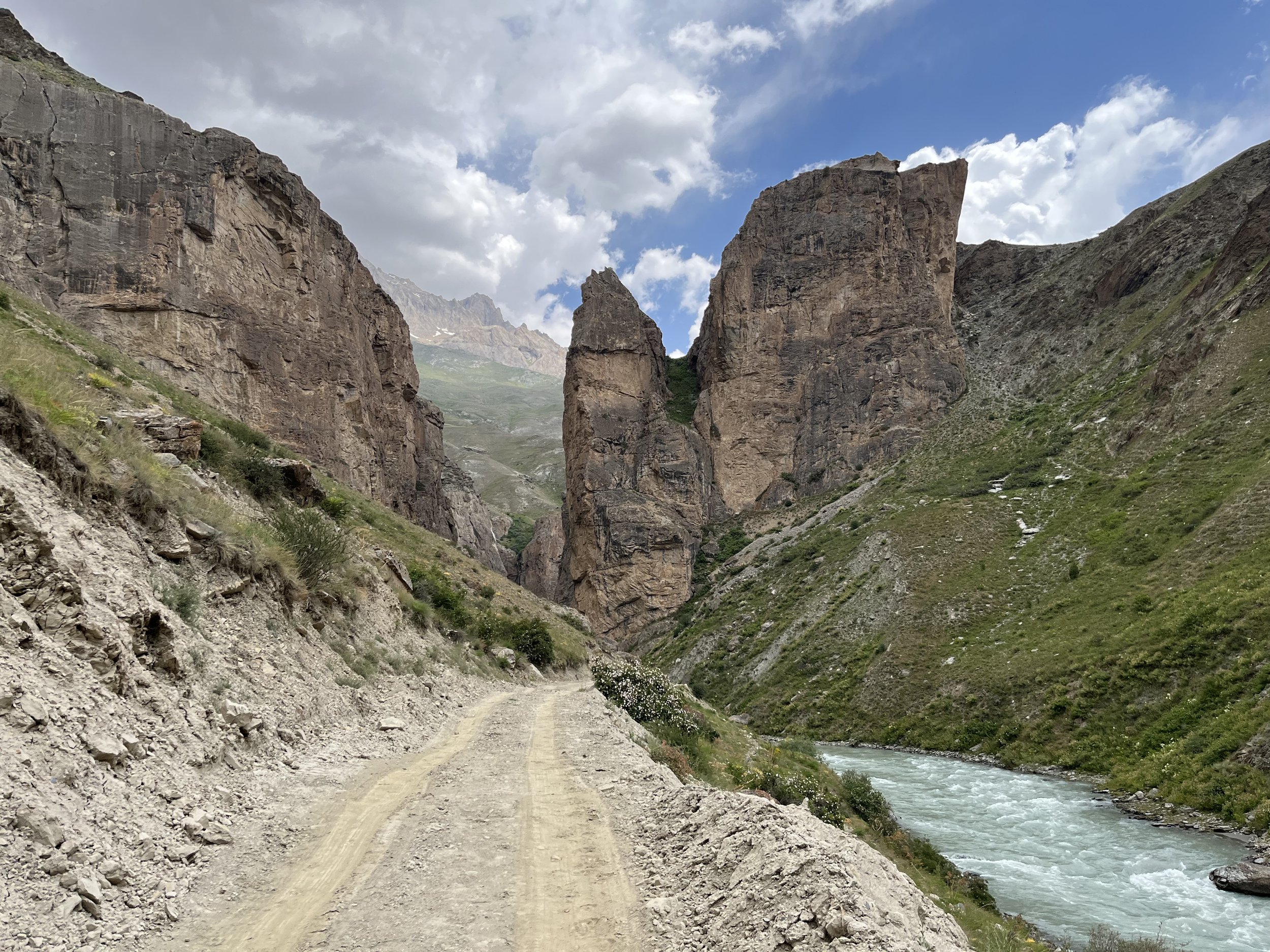
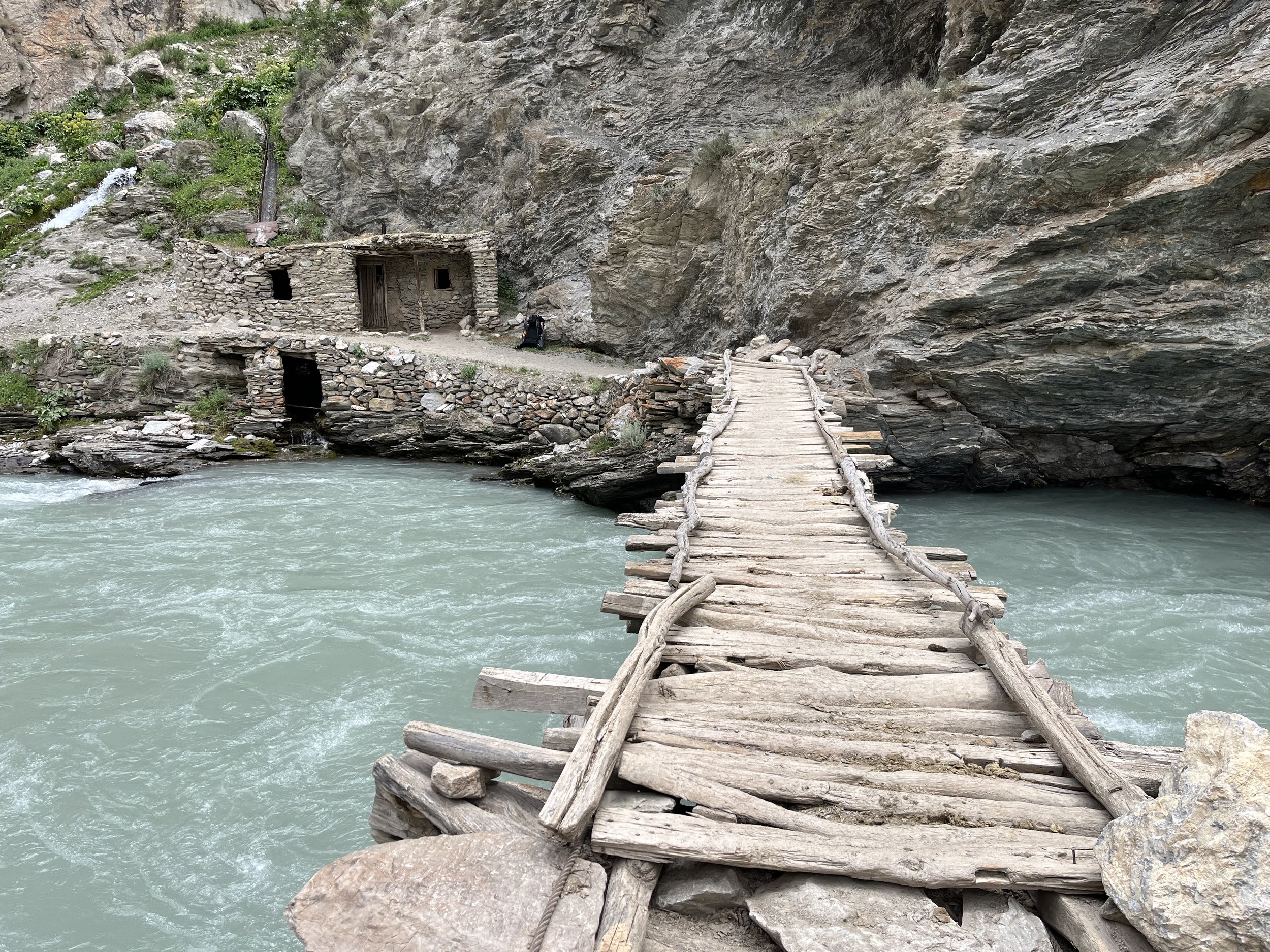
The sideshow below is a preview of the entire route.


If you want to see video of this route, check out what I collected while I hiked (YouTube links):
From Moghiyon to the Seven Lakes (Haft Kul)
From Seven Lakes to Immat Icefall (after 5:30 the video goes off route)
Down the Revut Gorge in the steady rain (an uncommon occurrence in mid-summer)
A narrated video following a shepherd caravan across Ti-Shakh Pass (after 18:40 the video goes off route)
Basic Trail Facts
Best time of year: Early August through mid-September (the least amount of unmelted snow up high, and the driest months of the year). Also, later in the summer and early fall there are smaller numbers of livestock up high - or they are off the main trails and up high on ridges (and therefore fewer shepherd guardian dogs to encounter).
Direct of Travel: From west to east starting in Moghiyon is best. This allows for gradual acclimatization to high altitudes.
Permits: None required for this region, a standard tourist visa is good enough (you don’t need the GBAO region permit unless you also plan to travel the Pamir Highway before or after this trip). But you must pay a small fee per day at Alauddin Lake and near Kulikalon Lake. It is/was $2 per day, so it should be $6 to get through this area with 2 nights camping and 3 days hiking (split between two different forest rangers on either side of Alauddin Pass).
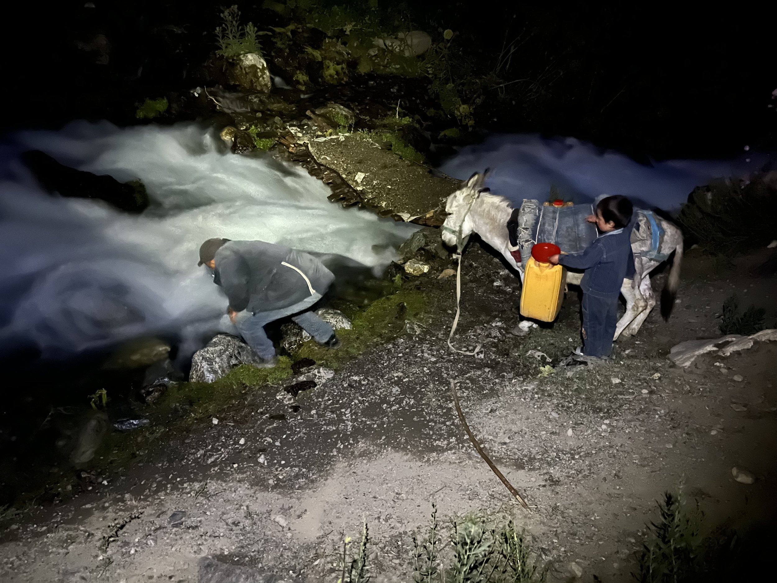
Isolation: I used shepherd trails and sometimes roads (but only when absolutely necessary). In a few locations there is no trail at all and I was alone in open terrain. However, thanks to mountain villages and shepherds, I met a person on every day of my hike except for one (and on that day I could see shepherds off the trail in the distance).
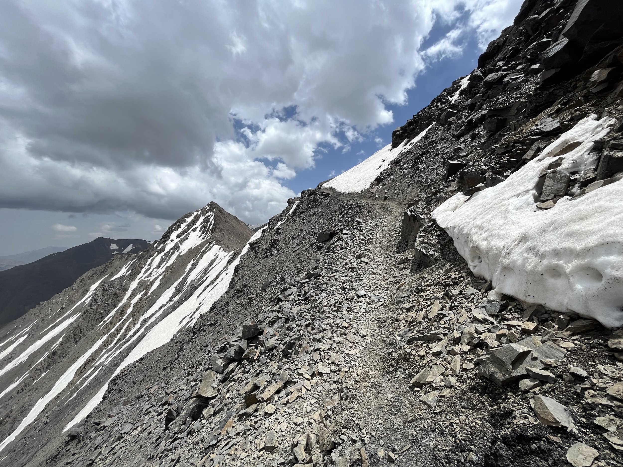
How high is the Sodiana High Route? Not as high as some of the trekking passes in the Pamir mountains, but still high enough to require some acclimatization and caution. The highest pass is Chimtarga Pass, at about 4760 meters (15,620 feet). If you skip Chimtarga Pass, then the next highest passes are just below or just above 4000.
How much is off-trail? By distance, maybe 15% off trail and 20% on very vague and hard to see trails. About 10% of this route is on mountain roads, but they are very pleasant with little to no car traffic. Another 5% is on mountains roads that are not so great. There is one 20km stretch on a highway (you can easily pay for a taxi ride to skip this).
Practical Information
Crampons and an ice axe? It depends. The largest possible weather window for the Sogdiana High Route is mid-June until late September. If you want to do the full route starting in June, you will need to bring an ice axe and crampons as the higher passes will have steep snow slopes.
If you don’t want to bring crampons and an ice axe later in the summer (even in August and September), then you might need to skip Chimtarga Pass and take the low route alternate via Artuch (you can make the very scenic hike to the bottom of Chimtarga Pass to see if snow is blocking it). You’ll also have to skip the Ti-Shakh Pass and Jindon Pass alternates at the end of the route if you don’t have crampons and an ice axe. You can go to the bottom of Ti-Shakh Pass and turn back if you don’t like the conditions. However, in certain years Chimtarga Pass and Ti-Shakh Pass will never be snow and ice free on the steep sections, and you won’t get through without crampons and an ice axe. The alternate route through Jindon Pass on the north side is never snow and ice free.
Food and resupplying: Resupplying on food is not easy. The villages on on this map offer mixed services. You will need to do some heavy food carries to get you through sections that have no decent village grocery stores. How much food will you need to carry? It depends on your speed and how much weight you can carry in your backpack, among other factors.
For the first section, it’s over 190km from Moghiyon to Sarvoda, and through Chimtarga Pass you will be very, very slow. Aside from this, the trails are not too rough, and you can go at a good pace for the majority of the distance. Check elevation differences to factor in how much that will slow you down. I personally would do a food carry for this entire distance, but other may be too uncomfortable with that much weight. How to reduce the amount of food? In the guesthouse in Padrud you can get dinner and breakfast. And you can exit down to the village of Ghazza to do the same, and attempt to buy some bread, nuts and dried fruit for the road from your host (I didn’t see a small village store here on the main road, but I didn’t ask or go into the village to see what’s available). If you have the time and money, you could get a driver to take you to Panjakent and back to resupply there. Next you have, in the tourist high season in July and August, a possible chance for a meal purchase at Alauddin Lake and on the other side of the Alauddin Pass by Kulisiyoh Lake. These areas are the closest you can find to a tourist trap, and you may have to pay quadruple prices. By Kulisiyoh Lake there was at one time a tent set up selling alcohol, bread, alcohol, snacks, and alcohol, all for rather extreme prices. Is it still there? Who knows. Your final destination in this section is the town of Sarvoda, with grocery stores and small food vendors.
The second section, Ayni to Veshab, is short enough at 82km to not worry about carrying enough food. You can buy groceries in Ayni, and at your destination in Veshab as well (but with less selection in Veshab). Try to buy bread, nut and dried fruit from the guesthouse owner in Veshab. These items are often not for sale in small village shops.
The third section, Veshab to Langar, is 126km. There are small village grocery stores in the village of Kazdon. But that is too soon after Veshab to be of much help to you. The village of Ghuzn at about the halfway point has small village convenience stores. Everybody, including me, reports different options available on the different dates they went through. There may be few choices in Ghuzn, or maybe someone opens up a nice new grocery store. To be safe, I would have enough food for the entire section.
The final section is 88km. The terrain is rough and the ascents steep and slow. You will need more food than on the previous 82km section.
How about local hospitality? The most popular areas of the Fann Mountains will give you a smile and a friendly wave, and that’s about it. In the less travelled areas you will often get invites from shepherds or villagers for tea, bread, dried fruit, nuts, candy and maybe a meal. I used to try to pay - multiple times. But I’ve never been successful. I gave up eventually, and I now bring along small lightweight souvenirs to hand out as gifts for people who help me or host me. I bring flag patches, the type backpackers used to stitch onto their bags. If you are from a country whose flag is too commonly seen (USA, Russia, China, etc.), bring a regional/state flag patch, university patch or sports team patch. Note that not every invitation is a real genuine invitation. Wait for them to insist multiple times.
Accommodation: Across the entire route I had the opportunity to stay in 4 official tourist guesthouses (Padrud, Veshab, Langar, and Ayni). There are also unofficial homestays in the Yaghnob Valley (probably no electricity or hot shower).
Prices online are out of date. The nicer guesthouses can cost up to $25 per person (particularly if you show up solo), while a simple homestay without electricity and hot water should be about $15. Pay in Tajik Somoni.
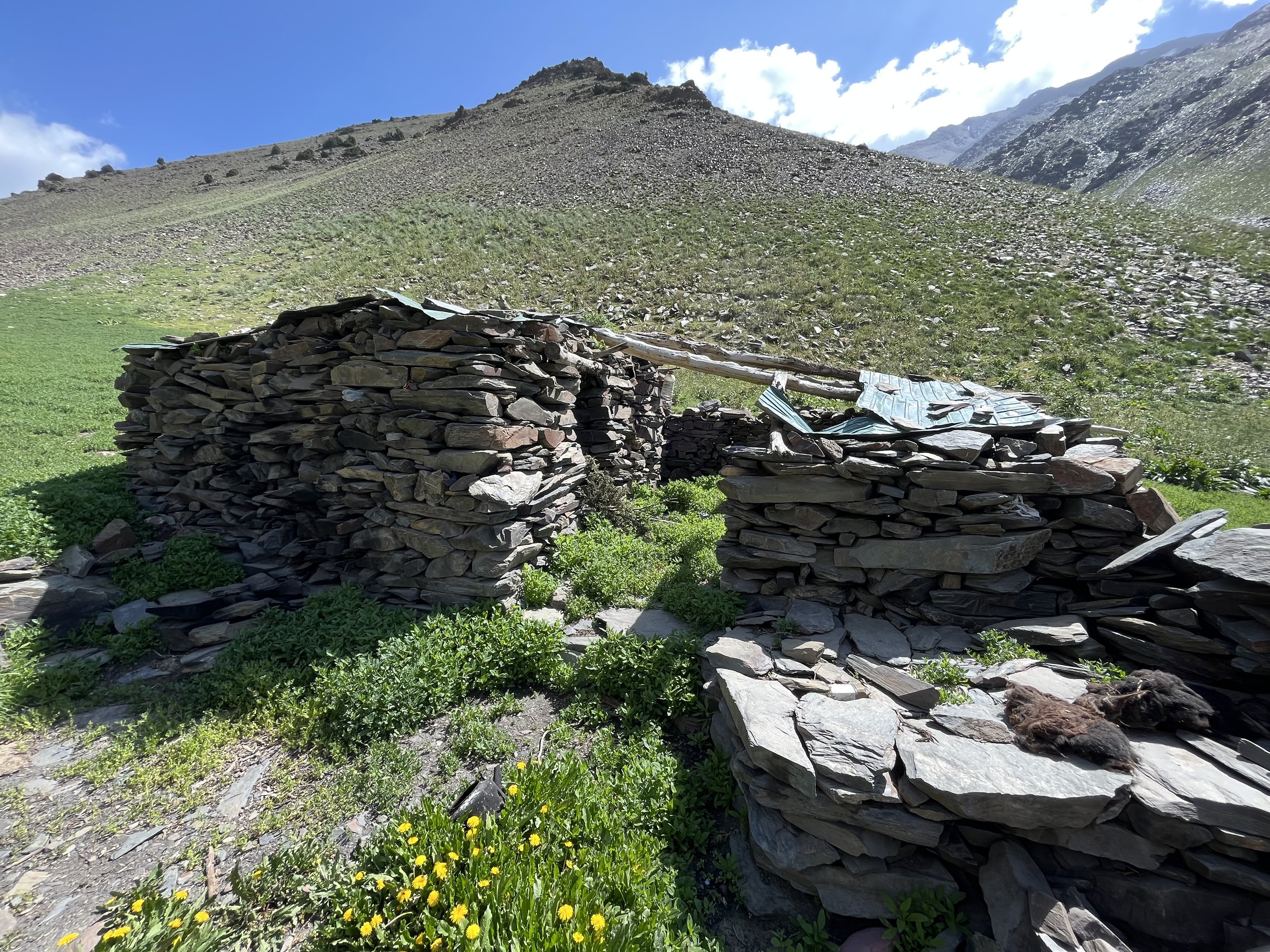
The rest of the time I was in my tent, and a few times I was invited in by locals to stay the night in a home or a mountain shepherd hut/tent.
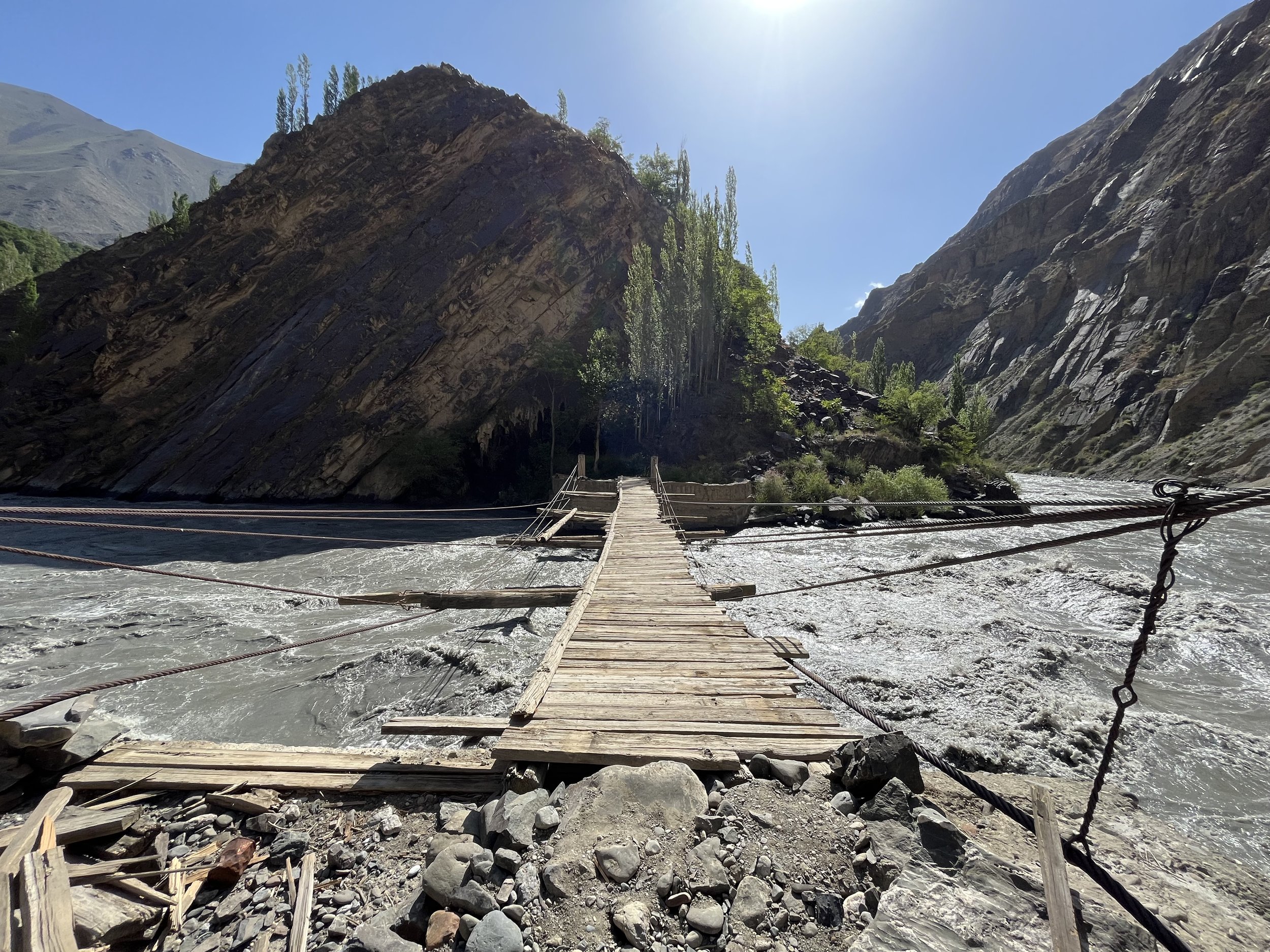
River crossings? All fairly easy stream crossings when there are no shepherd bridges. But this can change in heavy rain or if there is a record hot day and the river you are crossing is mostly glacier-fed.
Snow? Fresh snowfall in summertime is a possibility at above about 3500 meters.
Water: I’ve never had water problems along this route. I’ve added springs and small streams to Open Street Map (from a dozen trips to this area), so they should appear on your offline map download of Tajikistan. But I’ve not added them as waypoints on the GPX file. You do need to look ahead to see where the next stream or spring is.
Which map should I use? OsmAnd, for these reasons.
Special difficulties: Nobody speaks English anywhere along this route, except for the homestays in Padrud and Veshab (very basic English), and at Camp Artuch if you do that alternate route. Resupplying from village stores is not so good. Don’t expect a wide variety of food. You will not be able to buy gas canisters for your stove anywhere on this route. You will be in full isolation in some areas after you go above the grass and leave the shepherds behind. Don’t expect to see other tourists if you need help. The good news is that in every single village connecting by a road you can hire a driver to take you to Dushanbe or a regional hub where there will be drivers going to these cities.
Gear guide
Gear requirements: If you are attempting this route, then you should already be an experienced hiker or trekker. The usual high altitude trekking set-up will work fine. Bring your 3-season gear, with the worst case scenario being snow, wind and -5 Celsius overnight near a high pass. There is a chance of snow at any time June through September at 3500 meters or above. I sleep in a minus 10 Celsius sleeping bag, which is nice at high altitude. However, it’s way too hot at lower altitudes. But I choose too hot over too cold for safety reasons. As for clothing, I strongly suggest a rain-proof jacket and pants for the worst case scenario rain storm. The need to do some heavy food carries will rule out your use of a frameless ultralight backpack.
Special gear: I bring crampons and an ice axe. Do you need them? For Chimtarga Pass they are something you’ll need probably 50% of the time, depending on the amount of unmelted snow (read our guide to Chimtarga Pass). There are lower elevation alternates to Chimtarga. You may also need this gear for Ti-Shakh Pass and Jindon Pass. But you can always turn back from Ti-Shakh and end your trek there (right near the end). So you can leave the crampons and ice axe at home, but this may cause you to divert to an alternate route, especially in the early season.
Battery Charging: Guesthouses and hotels are where you can recharge your batteries and power bank (for the longest section you should have a 20,000mAh power bank at minimum). You can charge your batteries in the middle of the longest section by exiting to a guesthouse in Ghazza or to Camp Artuch.
How about late season (September) electricity rationing? I never asked in the many times I’ve been in the area. I really should have. Sometimes electricity in rural areas is reduced to being available for a few hours in the morning and again in the evening. But this varies from region to region. Obviously this could be a problem for you.
To play it safe, two 10,000mAh power banks are safer than one single 20,000mAh power bank (your could drop it in a river, it could die on its own, it could get fried by a power surge, etc…). If it gets close to freezing, sleep with the power banks (and your phone) inside your sleeping bag. And a sealable plastic bag or dry bag is good for protecting your batteries and electronics if you get wet from rain or a river crossing. As for quality, the Anker brand is very consistent.
Make sure your power bank supports 30W charging. And I don’t mean that the battery pack outputs 30W to your phone or other electronics, I mean that 30W is going to your power bank from the 30W charger. This takes some investigating, as manufacturers and sellers focus on telling you how quickly your battery charges your devices with how many watts (W), or “output,” but they often hide or don’t mention the info on how many watts their battery can “input” from a charger (important info for a hiker with limited time to charge their battery, and who may be competing with other tourists for limited electric outlets).
And bring a 30W charger. A regular charger (usually 5-10W) will take ~20 hours to charge a 20,000mAh power bank. You need a Euro plug, not North American plugs (if not in Europe, you can buy an Anker Nano 30W charger with European plugs from Amazon Germany or any European seller who delivers to the US/Canada/Australia etc.). You could just use a travel adaptor, but that’s adding a low quality item that can fail (or, like I’ve experienced, slip loose at an angle and stop charging). You should also have a 30W PD USB-C to USB-C cable so that your battery pack will actually charge fully overnight (the longer the cable, the better, some electric outlets are unreasonably high on the walls in this region). And an extra cable is always a good idea.
Do you just want a recommendation for a set-up? Sure, here you go:
Anker 537 Power Bank (24,000mAh)
Anker Nano 30W charger (European plugs)
Anker 643 USB-C to USB-C Cable
According to the manufacturer, this set-up above will allow you to recharge a dead 24,000mAh battery in 3.5 hours. Note that sellers sometimes don’t mention the Anker model number (537, 643, etc.) so you may need to compare specs from the Anker website to whoever you are buying from (if not buying directly from Anker). If you want to take my advice from farther above and combine two smaller power banks, then get two Anker Nano Power Banks (10,000mAh each) that support 30W charging.
Can you go higher than 30W? Sure. Look at power banks and chargers targeted towards laptop users. Generally you will see 65W charging input being advertised for that. Anker claims their 65W charger will fully recharge a 25,600mAh power bank (the “747” model in 2.5 hours). The main consideration for this is that the 65W charger will be significantly heavier (almost 4x) and bulkier if you are counting grams and ounces in your bag.
Planning your route
Skipping the highway walk: At Sarvoda you come to Tajikistan’s main north-south highway. You can walk the highway to Ayni as I did (24km and not very fun, but I felt safe with enough space to walk on the edge of the road - occasionally alternating sides), or you can get in a shared taxi to Ayni. You can negotiate with the drivers waiting around for an entire car, or just a seat in a car, or you can hitchhike on the road (but not for free). You can also get a seat in a shared taxi to Dushanbe (first half of the day is the easiest) to take a break for a night or two and resupply from a large supermarket. A seat in a shared car to Dushanbe from Sarvoda should be $6-10 depending on the quality of the vehicle. To Ayni from Sarvoda will be considered an inconvenience to drivers headed north, as they want long-distance passengers to Panjakent or Khujand. The ones who stop on the road while you hitchhike will be the most enthusiastic about you. Try a 20 Somoni (about $2) offer, and see how that goes.
Connecting to a longer route: How about hiking a longer route that includes the parts of historical Sogdiana that are in Uzbekistan? I did, for several weeks. It was hot, dry, overpopulated, overdeveloped and with scenery not on par with Tajikistan. I can’t make a strong recommendation.
This route overlaps the Pamir Trail in some sections. So you can take info from that trail guide, or even jump on sections of the Pamir Trail. At the end of the Sogdiana High Route you can continue eastward on the Pamir Trail if you don’t feel like leaving the mountains quite yet.
Route Options/Alternates: You can see the short-cuts on the GPX track easily enough. But this means you will be skipping a scenic point. I advise only doing this when you are running low on time or food, as I strongly feel these places are worth the extra time and effort.
I have done 100% of the full route that is provided as the main GPS track, with some passes and sections done multiple times. However, I have not done all of the alternates that appear as single waypoints. More info below.
Full description of alternates: The first alternate is the 2.7km trail (one way) to the south end of Hazorchashma Lake. The lakeside trail is quite nice, and you can camp at the south end of the lake. I prefer camping at the south end to the north end, as the north end gets visited by cars, and some of the people are here to drink, be loud and break glass.
If you are ready for a high pass right near the beginning of the hike (maybe you’ve just come from the Pamir Highway or a high trek in Kyrgyzstan), you can go through Upper Chapdara Pass instead of Tovasang Pass. I haven’t done Upper Chapdara Pass , but the link provides info based on hikes by Russian trekkers and climbers.
You can skip the Sari Khadang birch forest and glacier viewpoint, but it would be a really bad idea. It’s a great glacier view and the only large mountain birch forest you will see.
If Chimtarga Pass is snowed in or you are not ready for such high elevation, you can see waypoints that make for a northern detour (including food resupply and guesthouses). It’s a road walk part of the way. Take the alternate route at Alauddin Lake if you want to walk by the ranger station and see if any meals are available (usually only in July and August).
If you want more acclimatization before attempting Chimtarga Pass, then make a route through Upper Amshud Pass. There is no trail through this pass - it is most scree and talus. You will be able to see Upper Amshud Pass form an viewpoint earlier in the hike.
You don’t need to do the loop around Kulikalon Lake, the view from the northern shore is good enough.
I really enjoyed my two trips up to the Immat Icefall, but if you are running out of food or time, then skipping this side trip to continue downhill is understandable.
You can take a taxi between Sarvoda and Ayni, or do a road walk, which I found safe but boring.
East of Ayni there are goat trails along the river on the south side. I really enjoyed the quiet and the view here. But in one area these goat trails were skinny, slippery and had a steep drop. A fall would definitely mean serious injury or worse. The safe route is the road walk on the north side.
In the area between Putkhin Pass and Kani Pass (Shahriston Mountains) is a nice little lake surrounded by juniper trees: Oykul Lake, recently renamed Mohkul Lake by the government. You can go to this lake as an alternate instead of through Chilbaroz (Qirq Qozik) Pass. It’s a nice lake, but if you feel that you’ve seen enough lakes you can skip this alternate. The big resort on this alternate route is for local groups - they reserve ahead of time and show up in a large groups and rent a big house. They are not set up for solo travelers who don’t speak Tajik or Russian. After this resort zone you must pass through a forest ranger checkpoint and pay a fee (I’m not sure how much it is, as a local group of tourists took me through the checkpoint in their car and they paid a flat rate per car). Expect the area between the resort zone and the lake to be full of local tourists on Friday, Saturday and Sunday in the peak summer season - some vodka, some halal.
From Kazdon there are three route options: Farzod Pass, Munjg-Farkou Pass, and a traverse over from the upper Kazdon gorge. If it is early in the season and there is still snow at top, take Munjg-Farkou, as the northern slope is not as steep as the other two routes. If it is later in the summer season, Farzod Pass is the most direct and easiest (but in early season there is a traverse of a steep snowy slope and you need crampons and an ice axe, as I did). The traverse from the upper Kazdon gorge is a speculative route. I HAVE NOT DONE THIS ROUTE. I just really liked the upper Kazdon gorge and the Mullo Sharshara waterfall, which comes straight out of a cliff. Not a good route in the early season, but once the snow is gone I think it should be OK (but with some possible scrambling). No locals were able to give me exact information on this traverse.
You can skip the side trip to the Padask Icefall Viewpoint and just go straight up the Surinov Gorge to Surinovi Bolo Pass, but I don’t recommend that. It’s a really nice side trip. Note that on the return trip down from the Padask Icefall I just walked the lower route again. On satellite I see sheep trails on an upper traverse, so I added an option there. But it may actually be faster to redo the lower route due to length and roughness of the upper trail (it could be lots of sidehilling on bad goat trails). I don’t know.
If Ti-Shakh Pass looks dangerous, turn around and go straight down the trail to the village of Valighond and end your trip there. There is nothing so spectacular on the other side or on Jindon Pass or Dehmanora Pass that you should take a risk for it.
Detailed information on passes and routes (including alternates):
Other passes only need minor comments. Putkhin Pass is very likely not the name of the pass people in the village of Putkhin below will use. They will use a pass name that is the same as an area in the upper gorge, or of the area on the other side of the pass. “Putkhin Pass” will likely only be used by people on the opposite side of the mountain from Putkhin. Kani Pass has a few different names (see the map), and is usually a good pass to aim for as shepherds cut a trail through the snow on this pass very early in the season.
Transportation to trailhead: Moghiyon is a 45km car trip on public transportation from the city of Panjakent. You could even wake up in Samarkand, cross the Uzbek-Tajik border after breakfast and be at the trailhead by lunchtime if all transport connects go well. For getting from Dushanbe to Panjakent, see Caravanistan’s guide. See also Caravanistan for getting to Panjakent from Samarkand or Khujand.
For getting from Panjakent to Moghiyon you can use the regular shared cars that leave from central Panjakent. The shared taxis to the trailhead in the village of Moghiyon can be found on Panjakent’s main road, 150 meters south-east of the central bazaar. This is clearly marked (“Moghiyon Shared Taxis”) on any regularly updated app that uses Open Street map data. Here you will find a side street and shared taxis lined up both on the side street and the main street. You will likely be approached by drivers looking to take you on an expensive private tour to the Seven Lakes. Say ‘no thanks’ and ask for the Moghiyon driver(s). Likely you can’t pronounce the ‘gh’ in Moghiyon, but they will perfectly understand ‘Mogiyon.’ The drivers to Moghiyon actually service both Moghiyon and the numerous villages and neighborhoods nearby. So specify ‘Moghiyon bazaar’ (on the map it is labelled as “Chorshanbe Bazaar”). I paid 25 Somoni for a seat. This is the local price, and very cheap for a destination in the Fann Mountains. The low price is due to the fact that tourists almost never go to Moghiyon, so the drivers are unaware of the practice of asking 3 to 20 times the local price. 25 Somoni is $2.50 at 2022 exchange rates, so when you go, check what $2.50 is at the current exchange rate. Also, expect the price to rise (in USD and Somoni), as the future of energy prices in Tajikistan appears bleak.
The drive is 45km, and the second half is on rough dirt roads. The route will be the same as the route to Shing and the lower lakes Seven Lakes, until the final 3rd of the journey when you leave the road in the gorge and head up to Moghiyon. The road is steep and slow, with views of a massive gold mine on the opposite side of the valley. Your driver may drop people off in front of their houses in neighboring villages, so don’t be alarmed if he leaves the main roads and goes “the wrong way.”
There is a border guards checkpoint on this road, and they may ask to see your passport (they take it, write down or photocopy your info and hand it back). Don’t worry, you are not going into any restricted border zones.
I welcome information on any section of this route if you visit. Contact info here.
Additional photo slideshow below…